If you’re looking for a different side of Singapore, spend a few hours exploring Tiong Bahru.
Unlike the city’s towering skyscrapers and busy shopping streets, Tiong Bahru is a charming, hipster neighbourhood. This is Singapore’s oldest public housing estate. The pre-war flats were built in the late 1930s and are still standing. There are heritage murals painted by a local artist. There’s a World War Two air-raid shelter tucked beneath one of the blocks. And one of the best hawker centres in Singapore is right here.
I put this trail together to cover the parts of Tiong Bahru that are worth visiting. It’s about 2.5 km and takes 2 to 3 hours or maybe longer if you stop for a proper breakfast, which I’d recommend doing.
Starting Point: Havelock MRT Station (Exit 2)
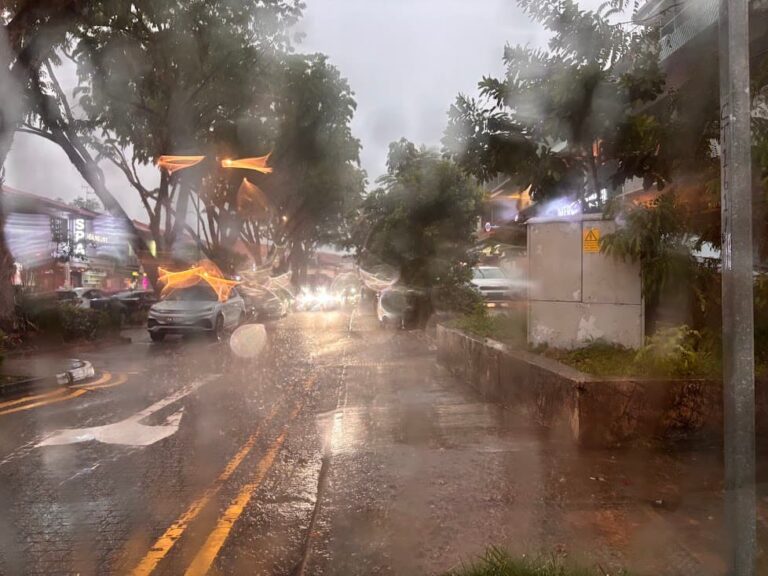
Take Exit 2 and follow my walking trail indicated for you inside the map. I made a slight detour because I want to lead you to a traffic light that makes it easy to get across. Don’t take the straight path from the MRT Exit, you’ll find it very difficult to cross Tiong Bahru Road because it is at bend and hard to see the cars and the cars tend to go quite fast at that crossing.
Stop 1: Tiong Bahru Market
Every good walk begins with a hearty meal and what better way to have it than at a popular hawker centre where you are spoilt for a variety of local dishes to choose from.
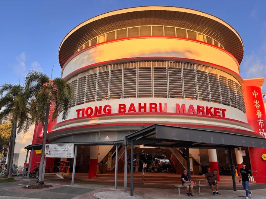
Tiong Bahru Market has long been the heart of the neighbourhood. The market has been on this site since 1951, when it was called Seng Poh Road Market. The original building was a simple wooden structure. It was torn down in 2004 and rebuilt — the current two-storey building reopened in 2006 and was designed with Art Deco touches to match the pre-war flats around it.
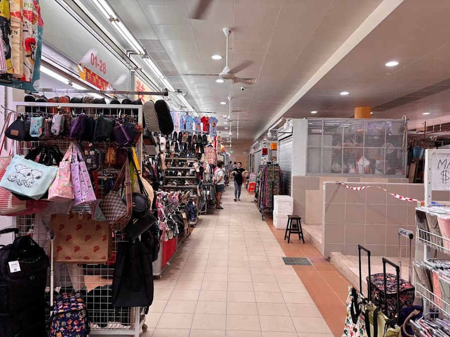
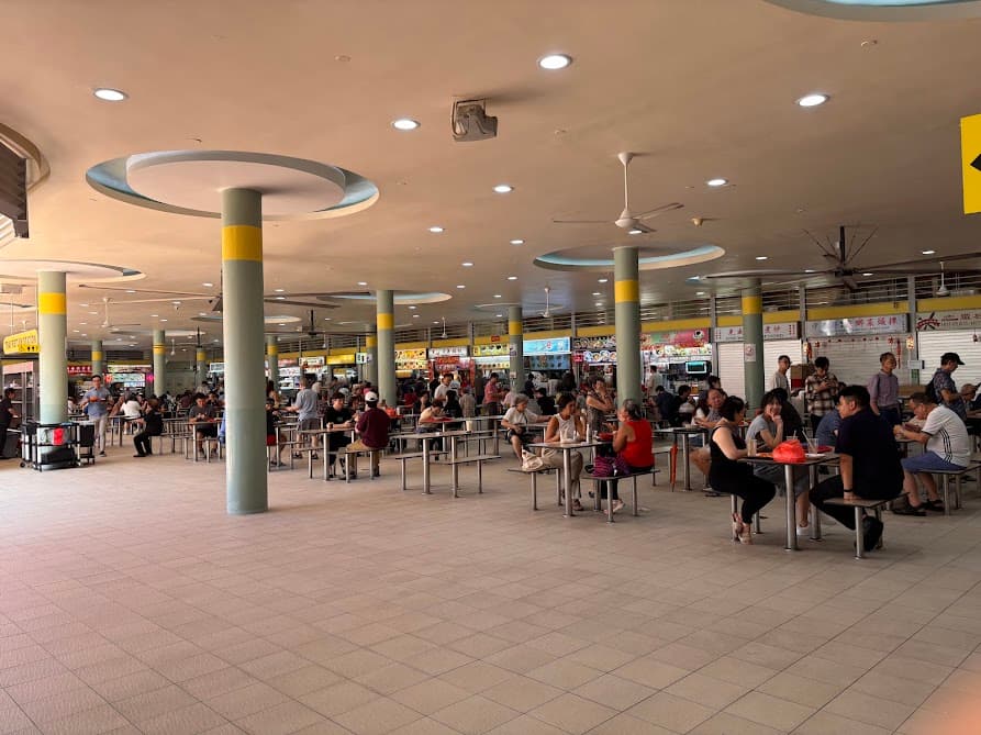
On the ground floor, you’ll find a traditional wet market where residents shop for fresh seafood, vegetables, meat and flowers. There’s also another side where you can find clothes and handbags too. Upstairs is one of Singapore’s best-loved hawker centres, serving a wide variety of local favourites and from my personal observation as a Singaporean, it’s the cleanest hawker centre I’ve come across and I like it because its spacious and not compact unlike other hawker centres.
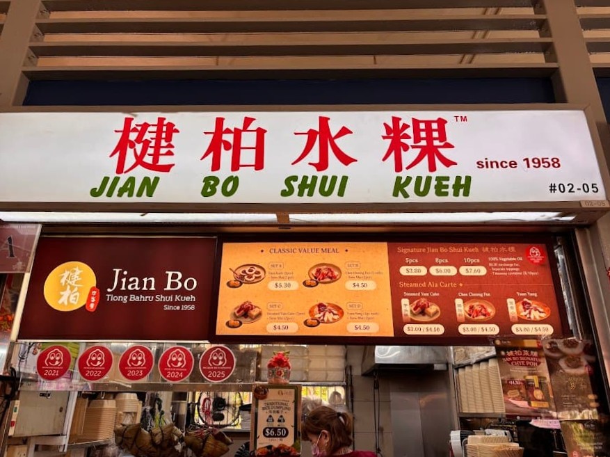
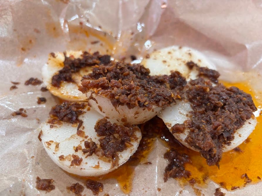
My must-have whenever I come to Tiong Bahru Market is the chwee kueh which are steamed rice cakes with preserved radish and it is undoubtedly the best in the entire island though I found that their chwee kueh has gotten quite oily recently. Just check out how much oil there is. I don’t remember it being this way the last time I ordered from them. Despite the amount of oil in here and how unsightly it looks but I assure you, it tastes good. Pair this with our local kopi and it’s a match-make in heaven.
Kopi is what we called coffee and I always order kopi c kosong. The c is the evaporated milk and the kosong (Malay for none or empty) without any sugar or condensed milk.
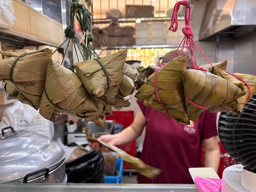
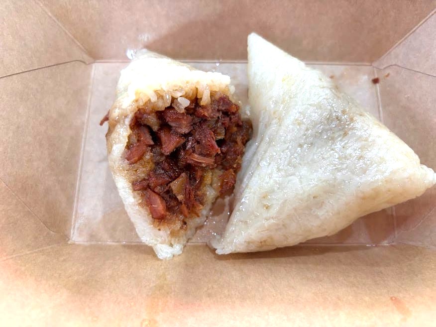
The great thing about having breakfast in local hawker centres is that there’s always something else to eat. I saw these nonya changs hanging in front of the same stall. These are glutinous rice dumplings wrapped in banana leaves and inside is a sweet minced pork with sweet melon. Savoury and sweet. Love it. If you see these try it and ask for the nonya version. There are two versions the hokkien one and the nonya one. The hokkien one is more meaty, drier and less sweet. I highly recommend the nonya one, hands down.
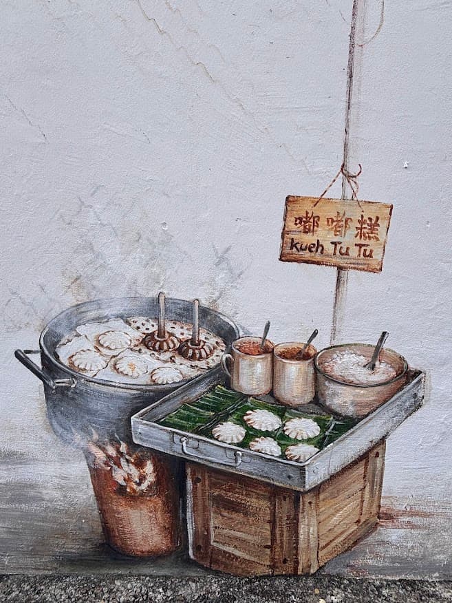
Stop 2: Bird Corner Mural
From the market, walk down Seng Poh Road and turn into Seng Poh Lane. The mural is on the corridor wall of Block 71.
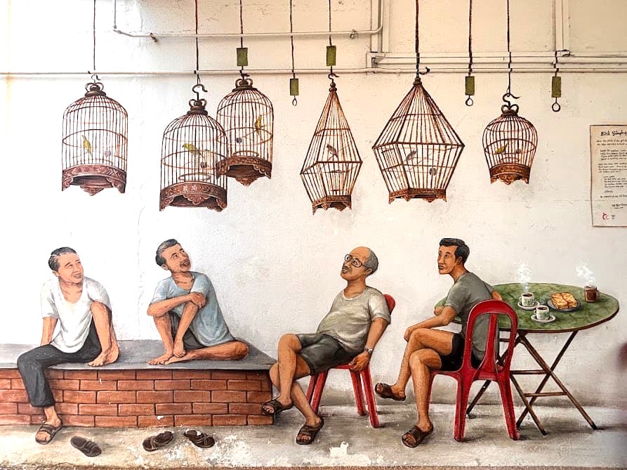
This was painted in 2016 by a local artist Yip Yew Chong. The scene shows an old kopitiam (coffeehouse) where residents used to bring their caged songbirds and hang them up while they had their morning kopi. That kind of bird-singing corner was a common part of estate life back then. I like his murals because the figures are life-sized, so it’s easy to step into the scene for a photo.
If you are exploring this Tiong Bahru trail with kids, get them to spot the cat. The artist hid a cat somewhere in his four murals in this trail.
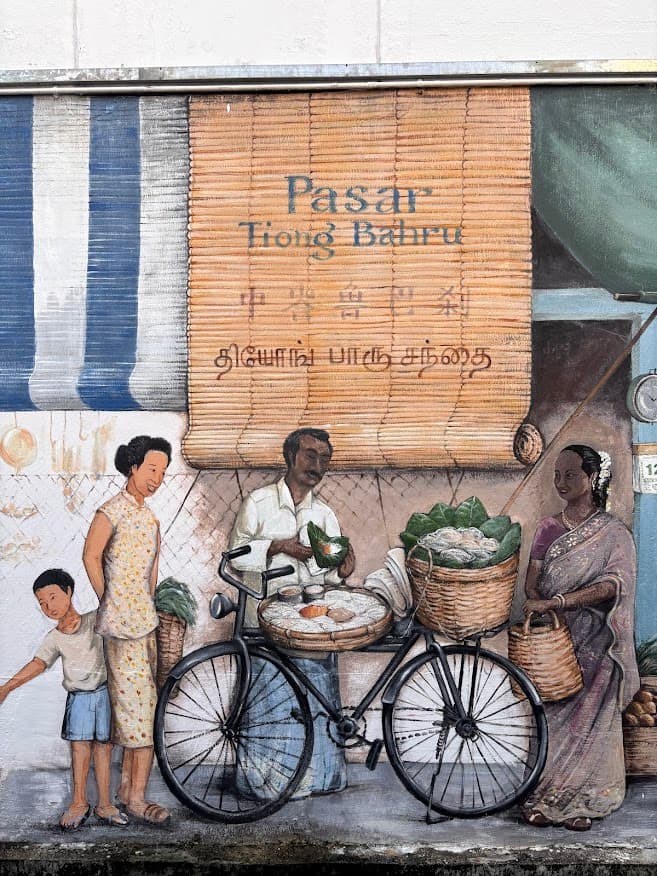
Stop 3: Pasar & Fortune Teller Mural
Walk to the back lane of Block 73 on Eng Watt Street. It’s not visible from the main road as the mural sits along this stretch of back lane. This is another of Yip Yew Chong’s murals which captures scenes that were once part of daily life across Singapore.
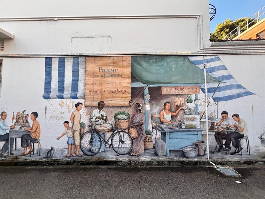
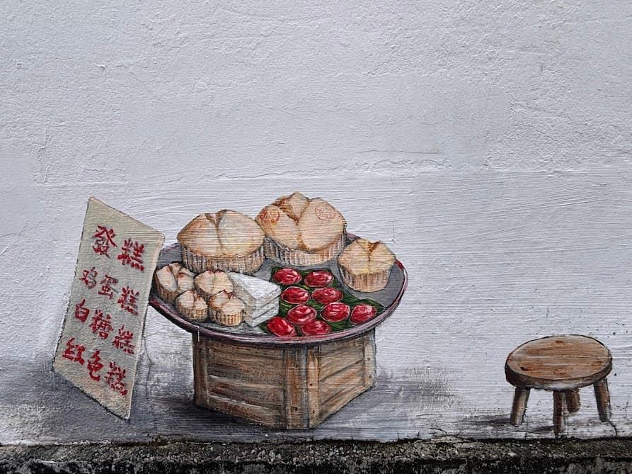
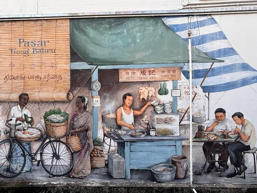
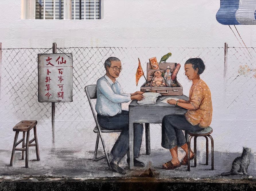
The word pasar means “market” in Malay and the mural recreates the lively atmosphere of traditional neighbourhood markets before supermarkets became more popular. It shows a busy outdoor market with food stalls selling laksa, chwee kueh, and putu mayam. Alongside the market scene sits a fortune teller, reflecting a time when many people sought advice on important life decisions such as marriage, business or moving house.
As you make your way to the next stop, you’ll pass the Tiong Bahru Community Centre on Eu Chin Street. What many visitors don’t realise is that the original community centre, opened in 1951, was actually a converted stand-alone air-raid shelter. This building is another reminder of the neighbourhood’s wartime history.
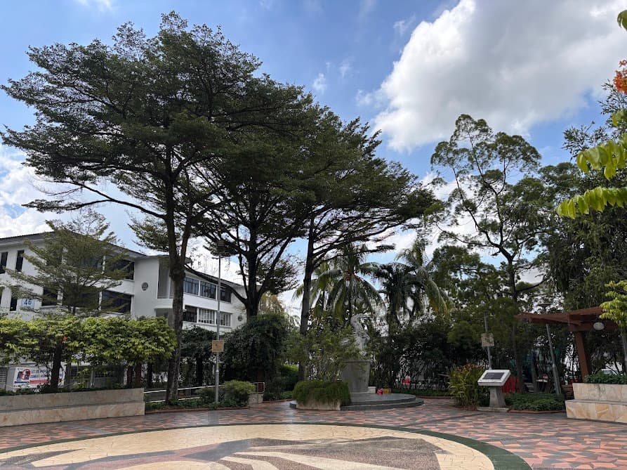
Stop 4: Seng Poh Garden & Dancing Girl Sculpture
Just across from the market is Seng Poh Garden, a small park that has been part of Tiong Bahru for decades.
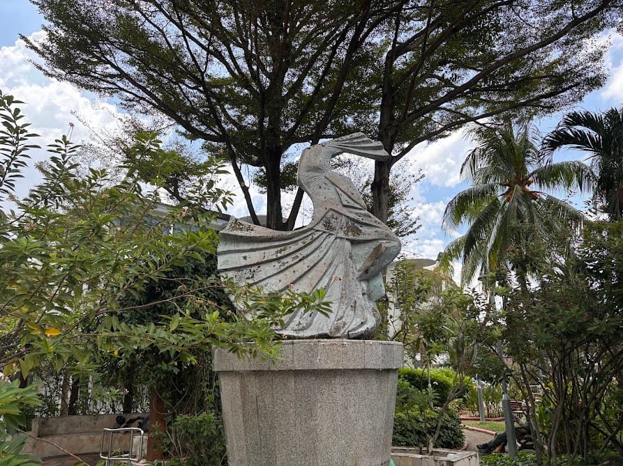
At its centre stands the Dancing Girl sculpture by renowned sculptor Lim Nang Seng who also made the original Merlion statue. Installed in 1972, the bronze sculpture has become one of the area’s most recognisable landmarks and a popular meeting point for residents. This was actually the first public sculpture ever put inside a Singapore housing estate park.
When it was unveiled, some residents thought it looked more like a swan taking flight than a dancing girl. Lim apparently wasn’t bothered as thought that swans were auspicious and would bring luck to the residents. Seng Poh Garden itself has been renovated several times over the years. Prince Charles and the Duchess of Cornwall visited here in November 2017 during a four-day trip to Singapore, and met with the community gardening volunteers.
Stop 5: Bak Kut Teh Mural
This next stop is actually sits outside the Tiong Bahru estate. Even though it is a few minute’s walk, it is actually located in another estate which is the Bukit Merah Estate. If you are short on time and want to only explore within this Tiong Bahru neighbourhood, then by all means, skip this mural.
But if you would also like to see how the newer housing estates are like which is very different from the Tiong Bahru estate and if you are also up for a bak kut teh meal at the eating place right next to the mural then it’s definitely worth the detour.
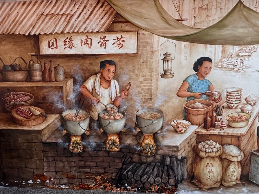
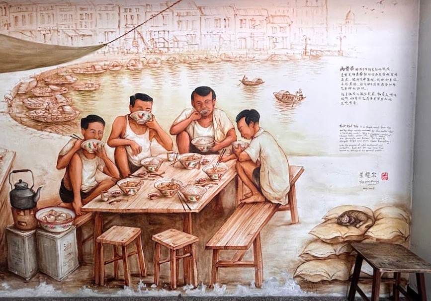
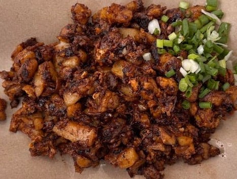
The artist Yip Yew Chong, painted this in August 2018 on the exterior wall of Tuan Yuan Bak Kut Teh (团缘肉骨茶). The mural tells the origin story of bak kut teh — peppery pork rib soup — when it was cheap, sustaining food for labourers working long shifts at Clarke Quay. The Singapore version is Teochew-style: peppery broth, lighter in colour compared to the Malaysian versions which tend to be darker and more herbal.
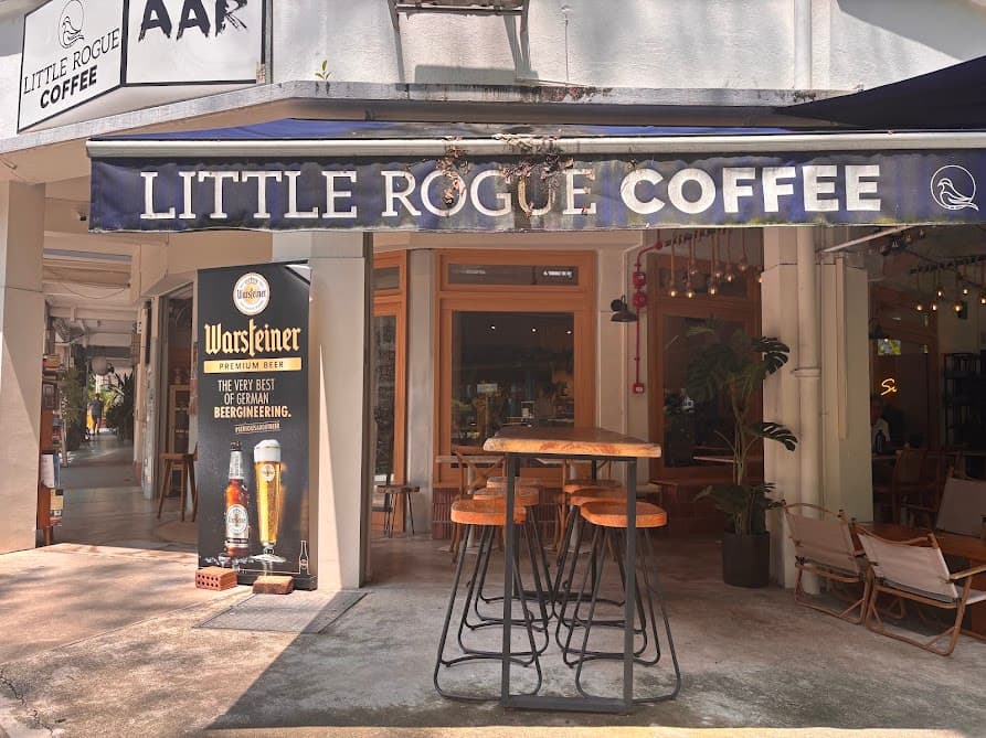
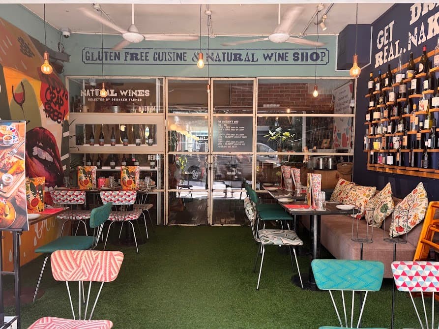
Stop 6: ‘Hipster Lane’ at Yong Siak Street
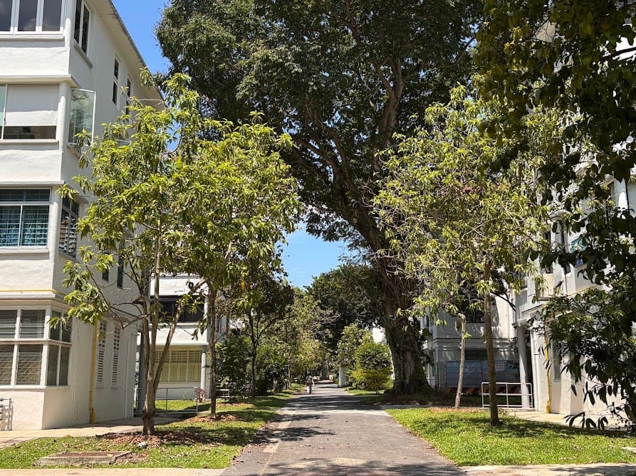
As I head back into Tiong Bahru estate again, I am greeted by the estate’s greenery. Take a right turn along this footpath into Yong Siak Street.
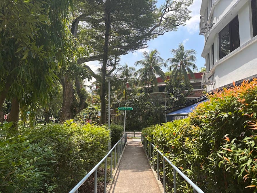
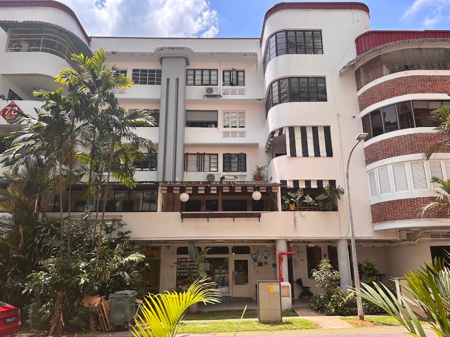
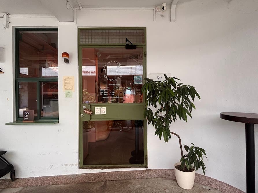
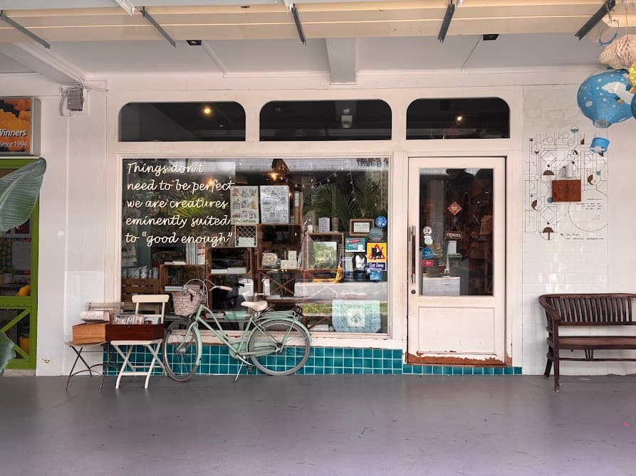
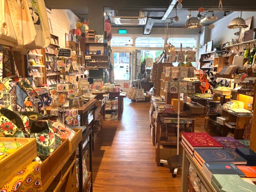
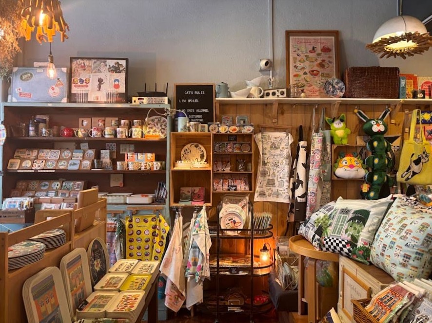
This is the stretch most people and even foreign media have associate it with the “hipster Tiong Bahru” label. There are independent cafés, a bookshop, a bakery — all located along the ground-floor units of pre-war housing blocks.
Stop 7: Air-Raid Shelter
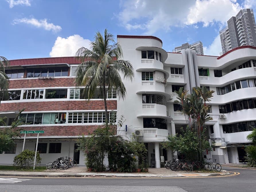
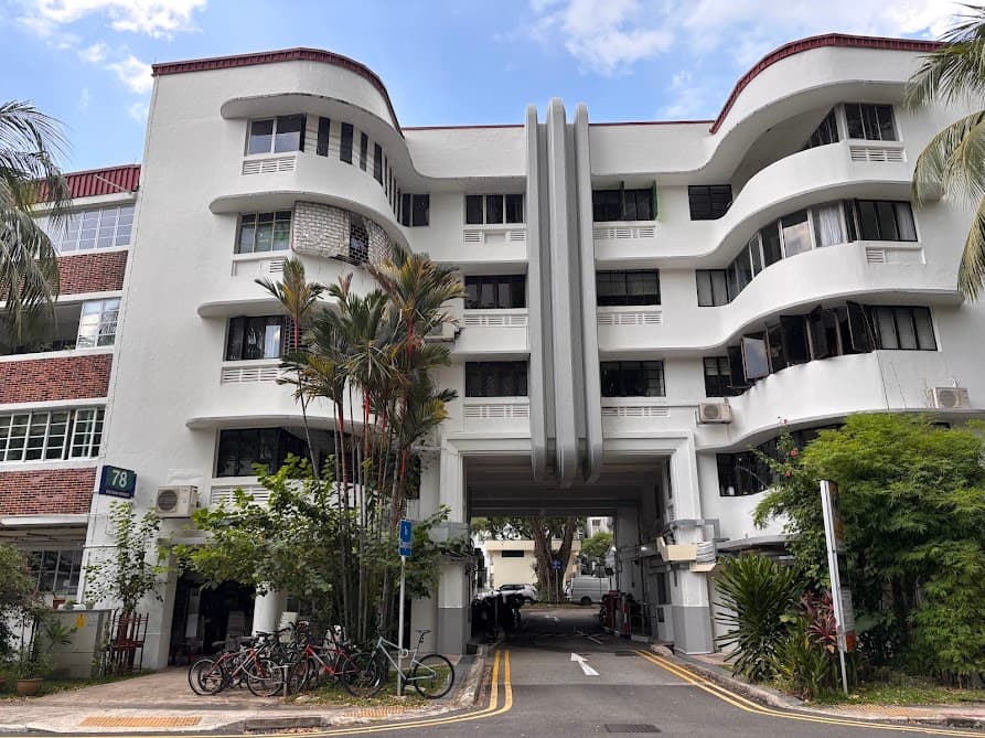
Block 78 is not only the largest block of flats in Tiong Bahru but also a horseshoe-shaped one. This block sits across Moh Guan Terrace and Guan Chuan Street and it is also Singapore’s first five-storey flat, with 70 units in total.

Walk to the carpark of Block 78. Located in the basement of this block is a significant piece of World War II history. The Air Raid Shelter.
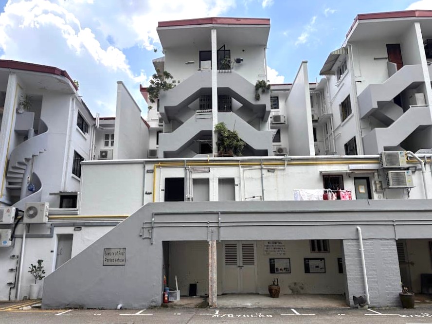
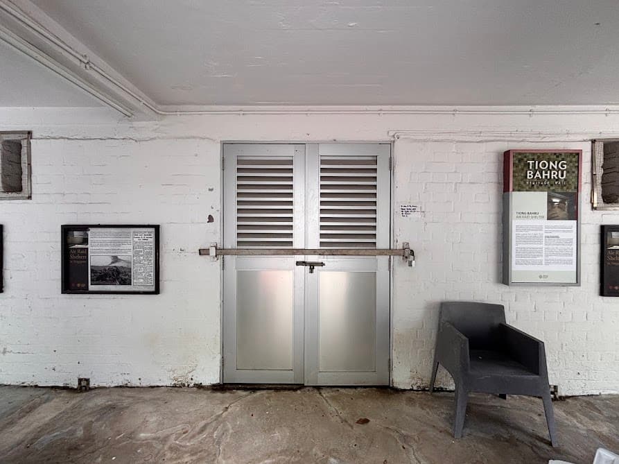
This is the only last surviving pre-war civilian air-raid shelter in Singapore. However, you can’t enter it as the shelter is mostly shut and not open for casual visits. It opens occasionally for National Heritage Board (NHB) guided tours. However, there are information boards outside that you can read any time.
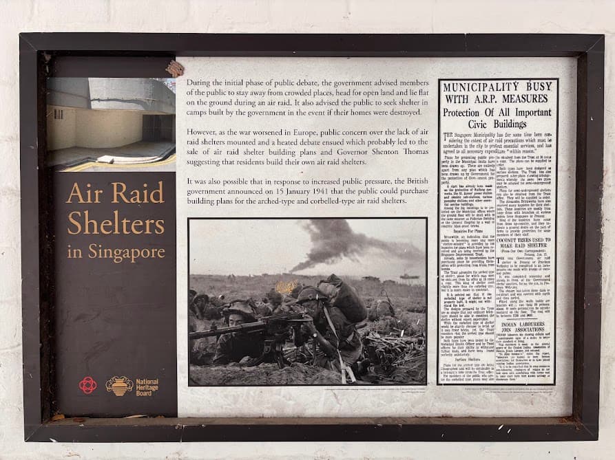
The shelter was constructed between 1939 and 1941. The walls are 19 inches thick. The shelter is about 1,500 square metres — roughly the size of 13 five-room HDB flats — and could hold up to 1,600 people. When Japan began bombing Singapore in December 1941, residents from this estate sheltered here. Singapore fell to Japanese forces on 15 February 1942.
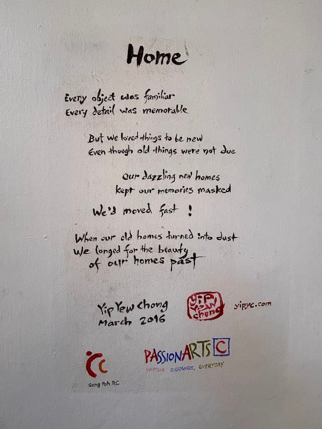
Stop 8: Home Mural
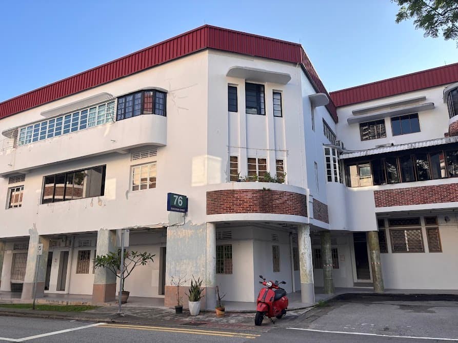
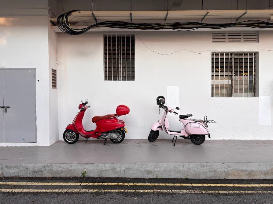
Along the way to the next stop, I took a photograph of Block 76 along Guan Chuan Street to capture the curved corner of the building’s feature sitting right above the cute parked Vespa. It has such a retro charm.
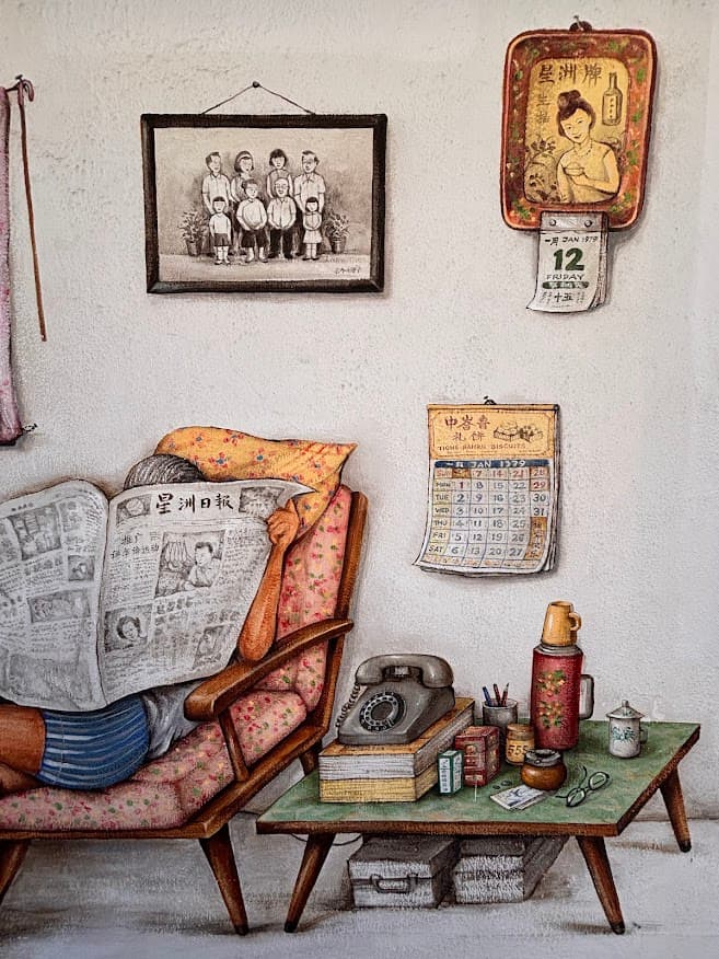
Continue along Guan Chuan Street and make a left turn into Tiong Poh Road. This last mural is on the corridor wall of Block 74.
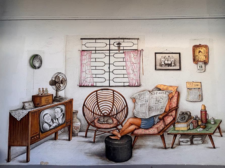
This one shows the interior of a Tiong Bahru flat as it might have looked in the 1970s or 80s — furniture, family photos, everyday objects. The artist painted it because he noticed visitors were always peering into the ground-floor flats, curious about what was inside. This is very typical of what most living rooms were like. I grew up in one similar to this so I can totally relate to this scene. And yes — there’s a cat here too.
As you continue walking along Tiong Poh Road, look for Blocks 81 and 82. Locals used to call them the “aeroplane blocks” because the long horizontal layout looks like the wings of a plane from a distance. They’re part of the same pre-war SIT estate, but each block has its own character — Block 81 is said to resemble an airship, Block 82 looks more like an ocean liner, with nautical semi-circle windows you can spot along the facade.
Stop 9: Eng Hoon Street
Along the way to Eng Hoon Street, I took a turn at Eng Watt Street and Seng Poh Lane because I just had to capture the vibes and retro feel in my photographs. I love how the estate has this nostalgic feel.

The street is named after Koh Eng Hoon, a Malacca-born merchant and commission agent who traded with Bugis traders in Singapore. Like most streets in the Tiong Bahru estate, the name honours a Chinese community figure of the 19th century.
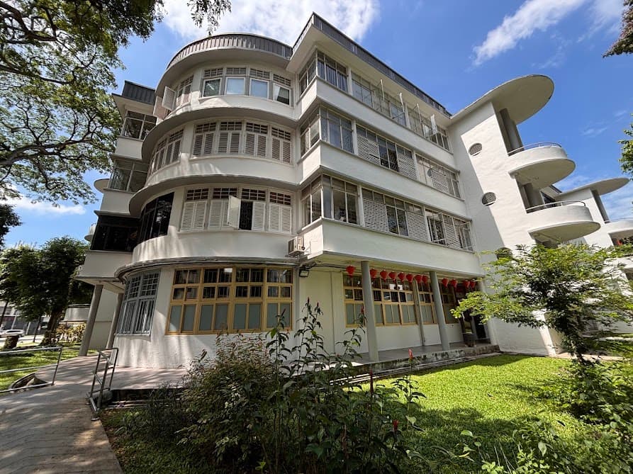
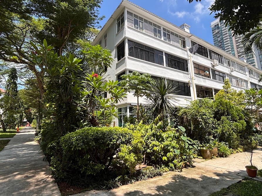
The pre-war housing blocks along Eng Hoon Street were built between 1936 and 1941 and are among the best-preserved buildings in the area. The most famous feature here is the concrete spiral staircases. They are built like open corkscrews without a center pillar and it is a highly popular photo spot.
At one end of the street is Qi Tian Gong Temple at No. 44 — Singapore’s oldest Monkey God temple, on this spot since 1938. At the other end is Tiong Bahru Bakery at No. 56, open since 2012.
Finishing Point: Havelock MRT Station (Exit 2)
Once you’re done on Eng Hoon Street, follow the walking trail on my map and head back toward Havelock MRT (Thomson-East Coast Line).
Where to Go After Tiong Bahru
Tiong Bahru sits right between a few other neighbourhoods worth exploring. Maxwell MRT station is 2 stops away where you can explore Tanjong Pagar or explore Chinatown from there.
If you’d rather spend the afternoon indoors, consider visiting the Asian Civilisations Museum or the Peranakan Museum. Both offer a deeper look into Singapore’s history and culture, and they’re easy to reach by MRT or bus from Tiong Bahru.