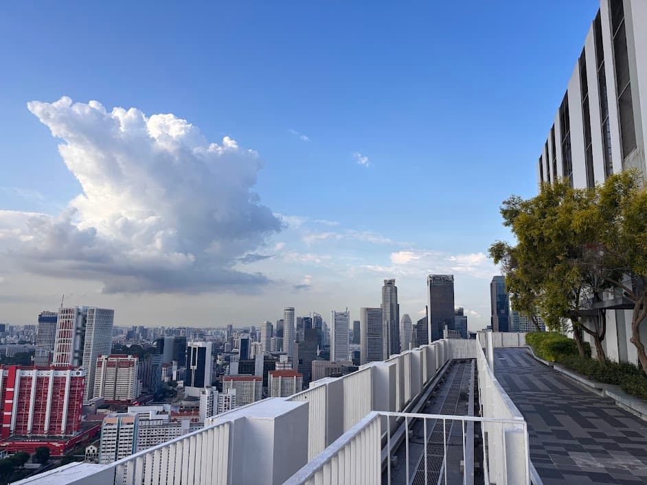
A panoramic view from the 50th-floor skybridge for just $6?
This step-by-step Tanjong Pagar walking route does more than just that. It brings you to a famous hawker centre, a walk through pre-war shophouses, the streets of colourful Peranakan homes, local neighbourhood estate AND more — all within a single walk.
I designed this walking trail for those who are short on time but want to see the REAL Singapore minus the typical crowd. Although It begins at a busy hawker centre but after that, this route becomes much quieter. I’ve mapped out the full route below.
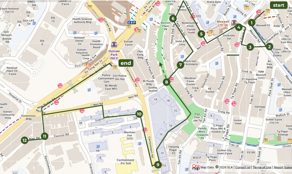
The 12-stop walking trail winds through Tanjong Pagar before ending at Outram Park MRT (NE3).
Self-guided · 2.6km · 12 stops · Start: Maxwell MRT Exit 2 · End: Outram MRT Exit 5
Each stop below is linked to its own section in this guide, so feel free to click ahead if a particular spot catches your eye.
- Maxwell Food Centre
- Singapore City Gallery
- The Wall, The Staircase & The Bus-Stop
- Jinrikisha Station
- Kreta Ayer Heritage Shophouses
- The Art Deco Charm of Tong Ah Building
- Neil Road Photo Stops
- Duxton Plain Park
- Skybridge at The Pinnacle@Duxton
- Everton Park HDB Estate
- The Provision Shop Mural
- The Peranakan Houses of Blair Road
Starting Point: Maxwell MRT Station Exit 2
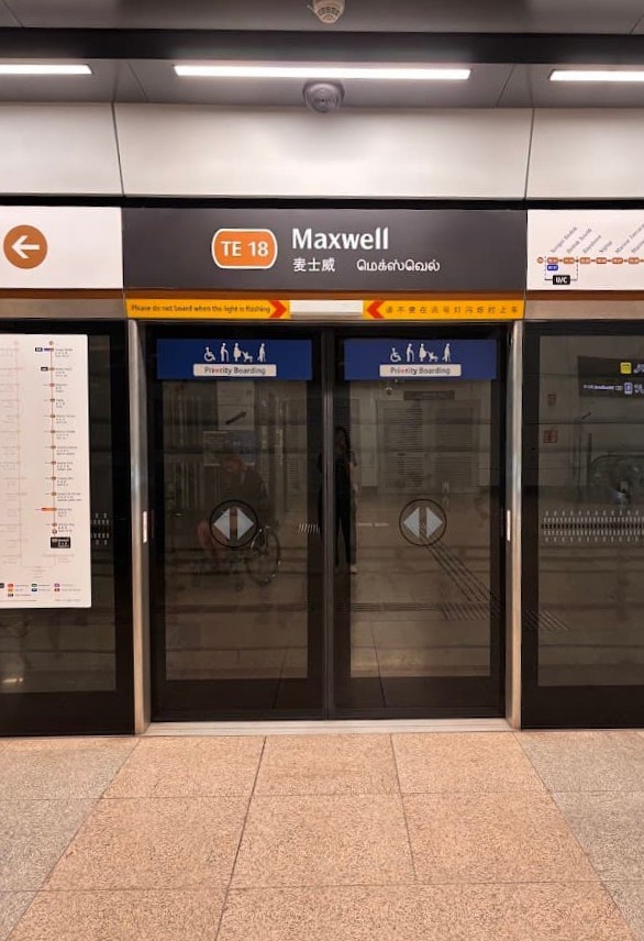
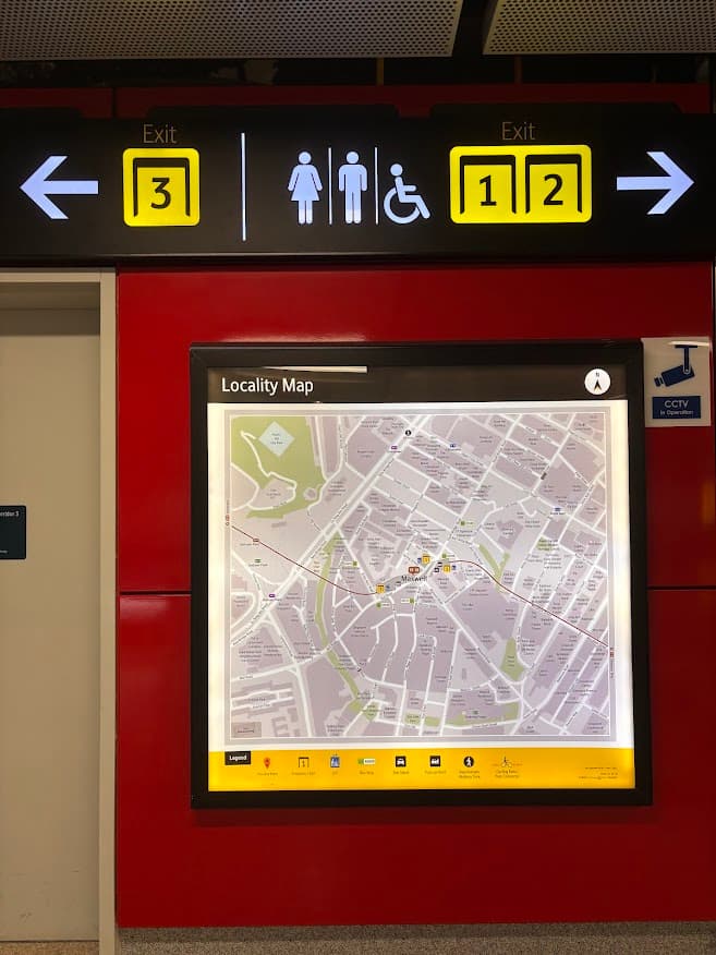
Arrive via the Thomson-East Coast Line (TE18) and head to Exit 2. This brings you right to the start of our Tanjong Pagar walking route.
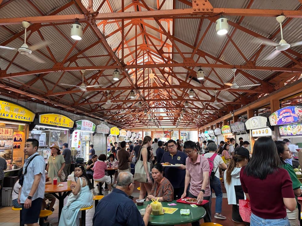
Stop 1: Maxwell Food Centre
No visit to Singapore feels complete without experiencing a hawker centre — plus, you’ll need to fuel up for the walking route ahead.
Maxwell Food Centre is one of the best places to see everyday local life and enjoy Singapore’s unique food culture. Maxwell Food Centre is one of Singapore’s popular hawker centres, with a wide variety of local favourites under one roof.
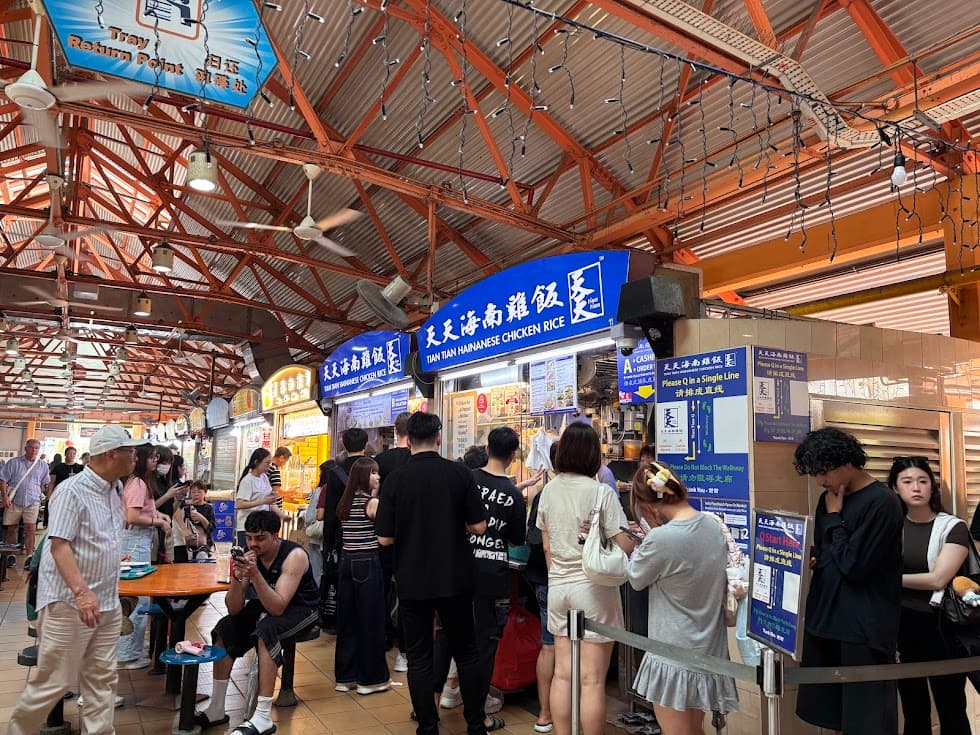
If you are unsure what to try, I would recommend starting with the famous Tian Tian Hainanese Chicken Rice. I must say that the chicken is both very tender and flavourful, which explains why it remains popular among both locals and visitors. The queue is often long but in my experience, it moves quite fast and I think it is worth the wait.
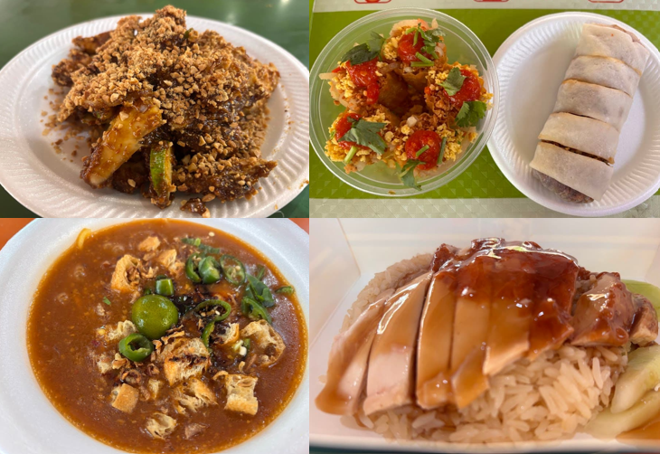
chicken rice (bottom right), mee rebus (bottom left). Most dishes are under S$6.
If this is your first time visiting a hawker centre, do check out my other blog post on how to navigate a hawker centre in Singapore and make the most of the experience. I’ll leave a link at the end of this article.
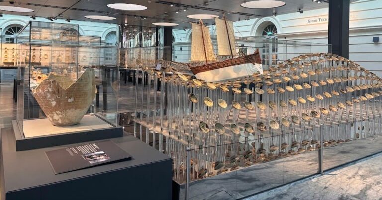
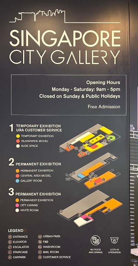
Stop 2: Singapore City Gallery
How do you design an entire city like Singapore?
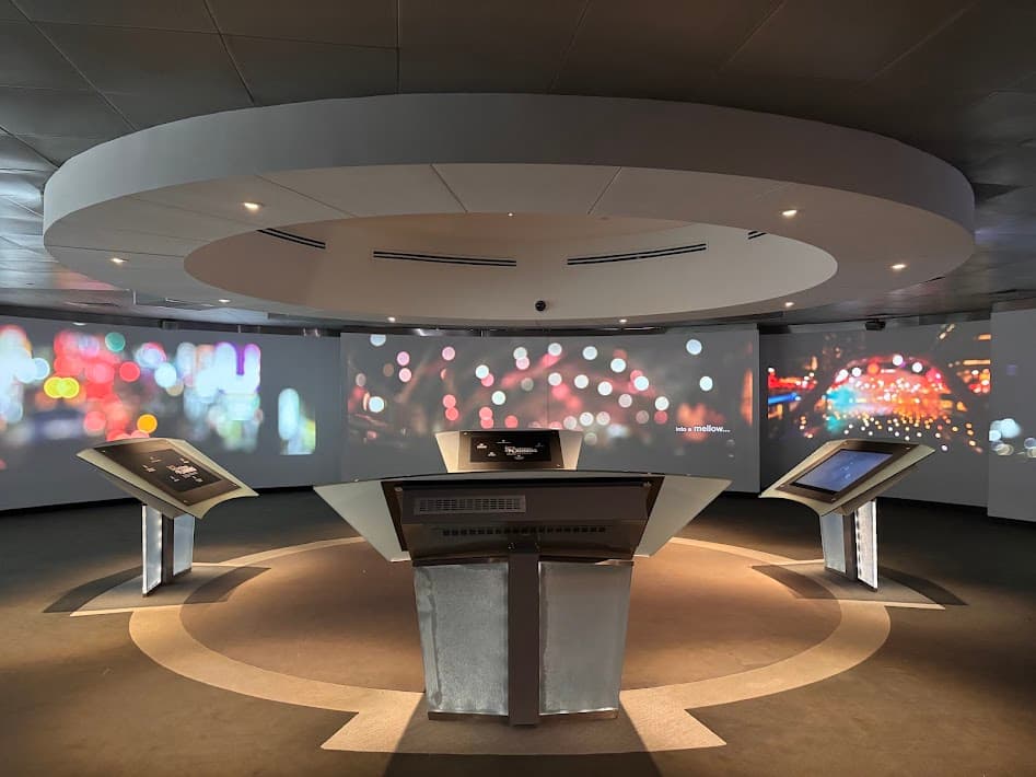
Located at the URA Centre, the Singapore City Gallery is a free attraction that reveals the answer through interactive exhibits and an impressive scale model of the entire island in which you can see how the city is carefully planned and how it has transformed over time.
The gallery walks you through Singapore’s journey — from early development as a small trading port and into the city you see today — showing how everything is thoughtfully designed to make space for living, working and moving around.

It’s a great stop to understand the city better, especially as you continue your walk into nearby heritage streets, pre-war shophouses and everyday HDB neighbourhoods.
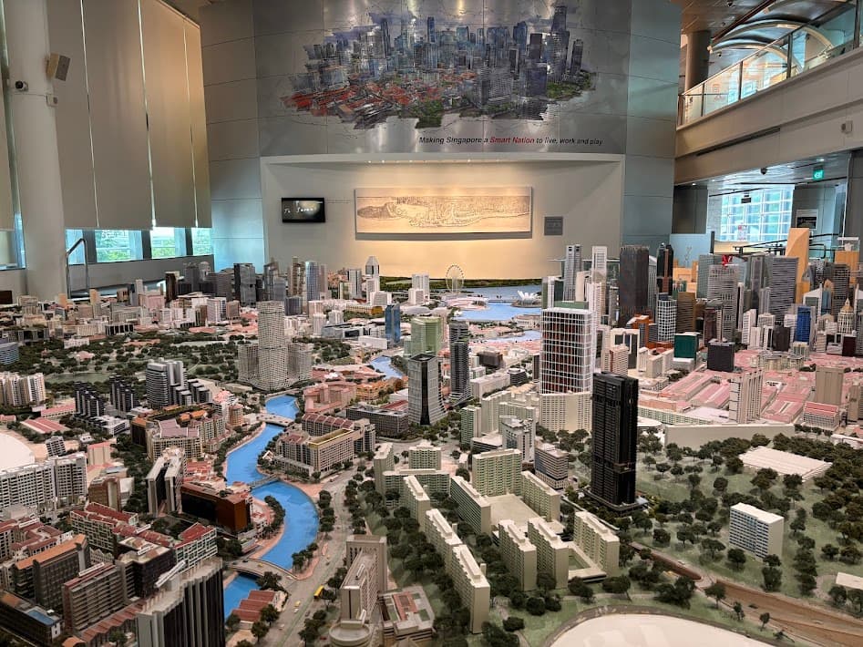
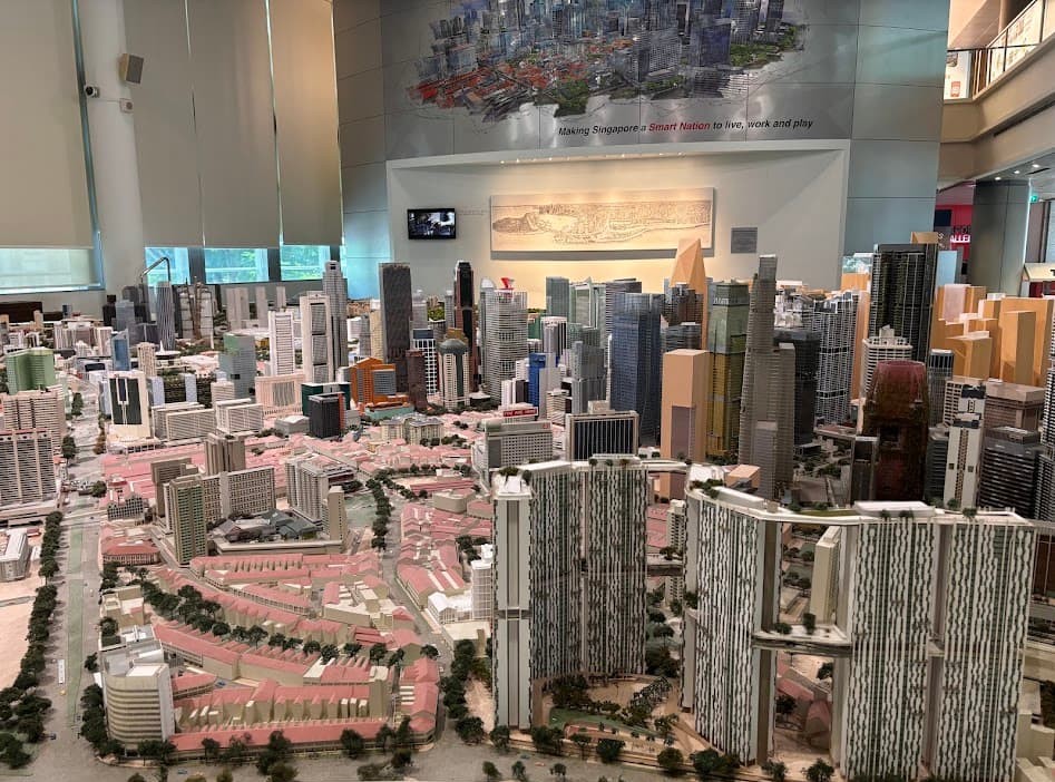
The highlight for me is the large-scale city model on the second floor — it gives you a different perspective of Singapore and helps you appreciate how much thought goes into shaping the city beyond what we see at street level.
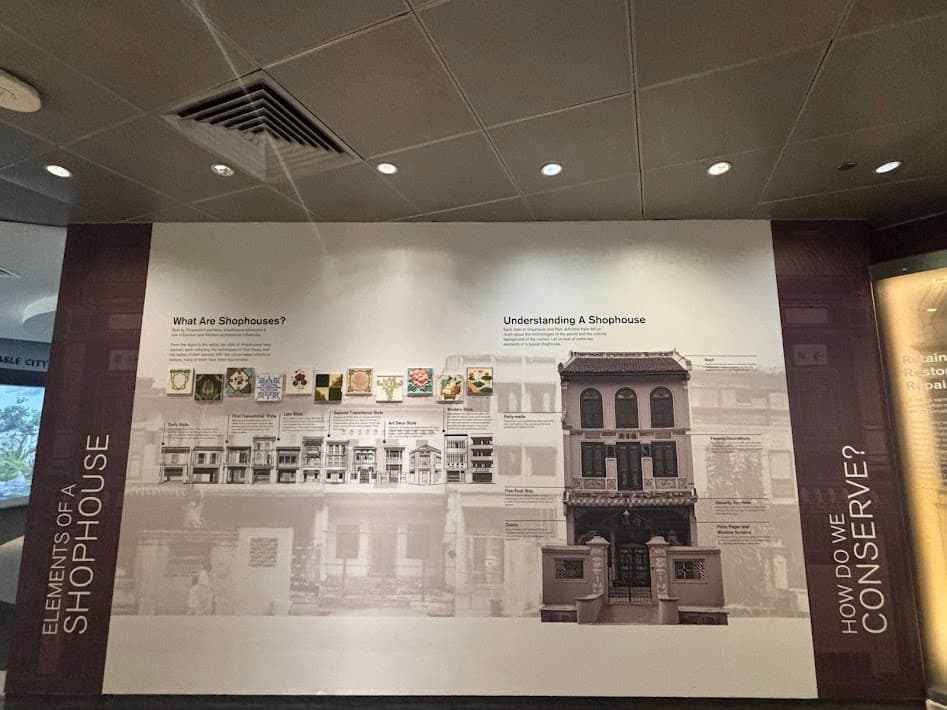
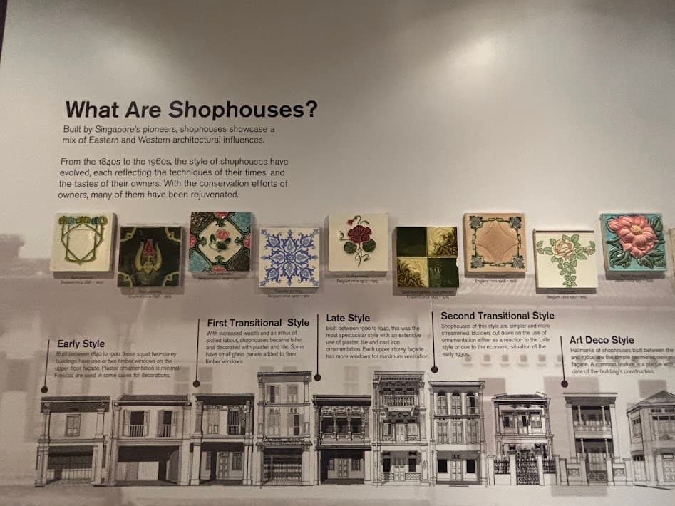
Visitors can also learn about Singapore’s heritage shophouses where people once lived upstairs and ran businesses downstairs. Today, many shophouses have been carefully conserved and adapted into modern spaces, allowing Singapore to preserve its heritage while keeping these historic streets alive for future generations.
Now it’s time to step beyond the gallery and see Singapore’s heritage come to life as you continue the walk and discover conserved shophouses along the way.
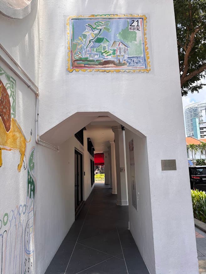
Stop 3: The Wall, The Staircase & The Bus-Stop
As you exit the Singapore City Gallery, cross Maxwell Road and head into Murray Street to discover interesting street features.
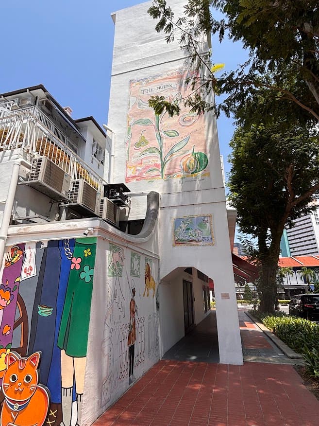
Hidden Murals
What an unexpected surprise — I came across this hidden mural tucked away in a quiet street corner as I was on my way to lunch at a nearby restaurant.
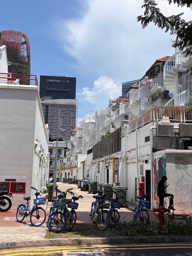
Spiral Staircases
At the same time, I also spotted a row of white spiral staircases along the rear facade of the same shophouses—a nice contrast between heritage architecture and the mural artworks nearby.
The Bus Stop
Want a good instagram shot that no one has done before?
Look for the bus stop located directly in front of the shophouses when you head back out to Tanjong Pagar Road.
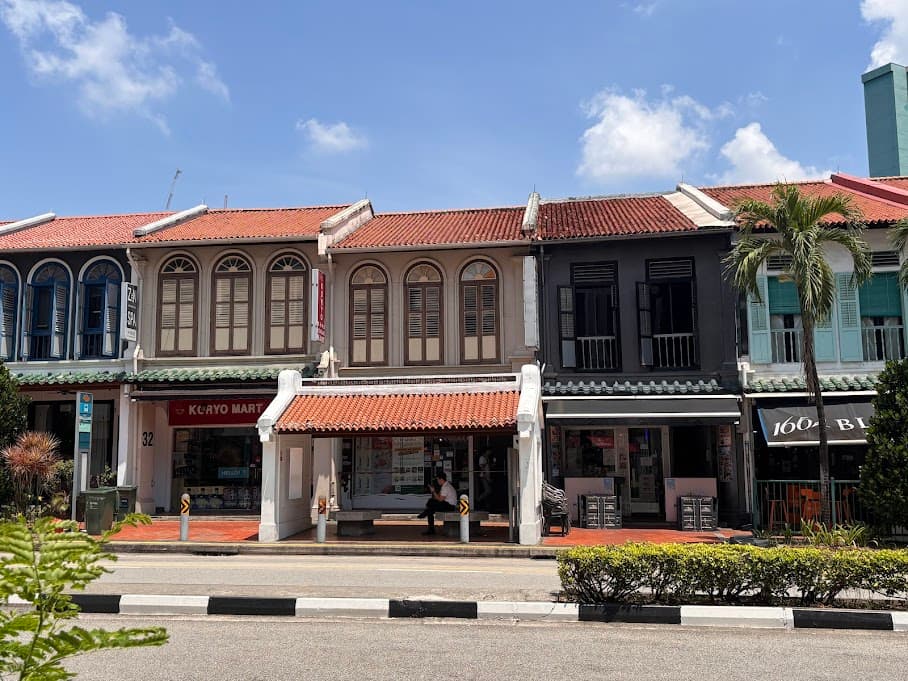
Unlike standard modern bus stops in Singapore, this one was constructed with stone-like pillars and a traditional tiled roof, seemingly designed to match the aesthetic of the nearby conservation shophouses.
From the bus stop, walk towards Duxton Hill and take two left turns to reach Neil Road.
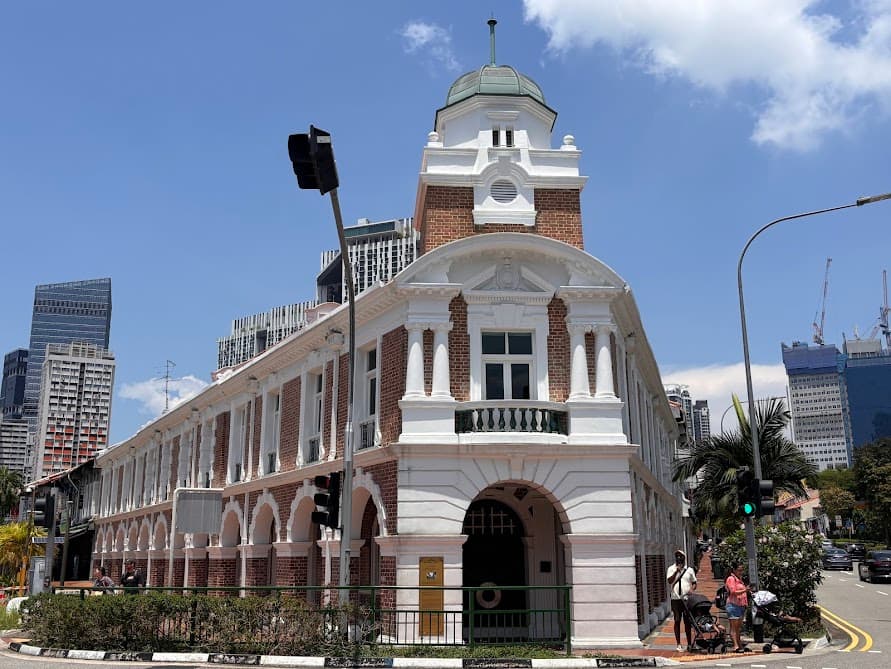
Stop 4: Jinrikisha Station
Did you know this heritage building was once, one of the most chaotic spots in Singapore?
Built in 1903, it was then a busy station managing thousands of rickshaws when they were the main mode of transport. Many people tend to walk past it without realising its history but I think it is worth a brief pause if you are in the area, just to imagine what this place was like back then.
- The Rickshaw: Rickshaws were first imported into Singapore from Shanghai in 1880. Cheap, nimble and requiring no fuel beyond human effort, they quickly became very popular. The name itself is Japanese — jinrikisha means “man-powered vehicle.”
- The Workforce: At its peak, there were over 8,000 registered rickshaws in Singapore, operated by as many as 20,000 to 30,000 pullers working in shifts. Most pullers were young immigrant men from southern China, enduring backbreaking hours for little pay, and many turned to opium for relief.
- The End of an Era: Rickshaws were eventually banned in Singapore by the British colonial government in 1947 because the work was considered too gruelling and demeaning.
- A Landmark Purchase: In 2007, the building gained attention when it was bought by Jackie Chan for S$11 million. It has since changed ownership and continues to serve as a commercial space.
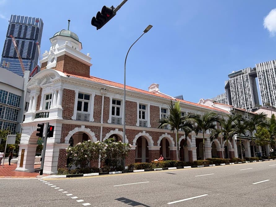
The building has survived World War II and decades of redevelopment. While it now houses restaurants and offices, its original Edwardian-style design is still clearly visible.
The best view is at the road junction from across the front of the building, where you can clearly see the facade that follows the shape of the road junction.
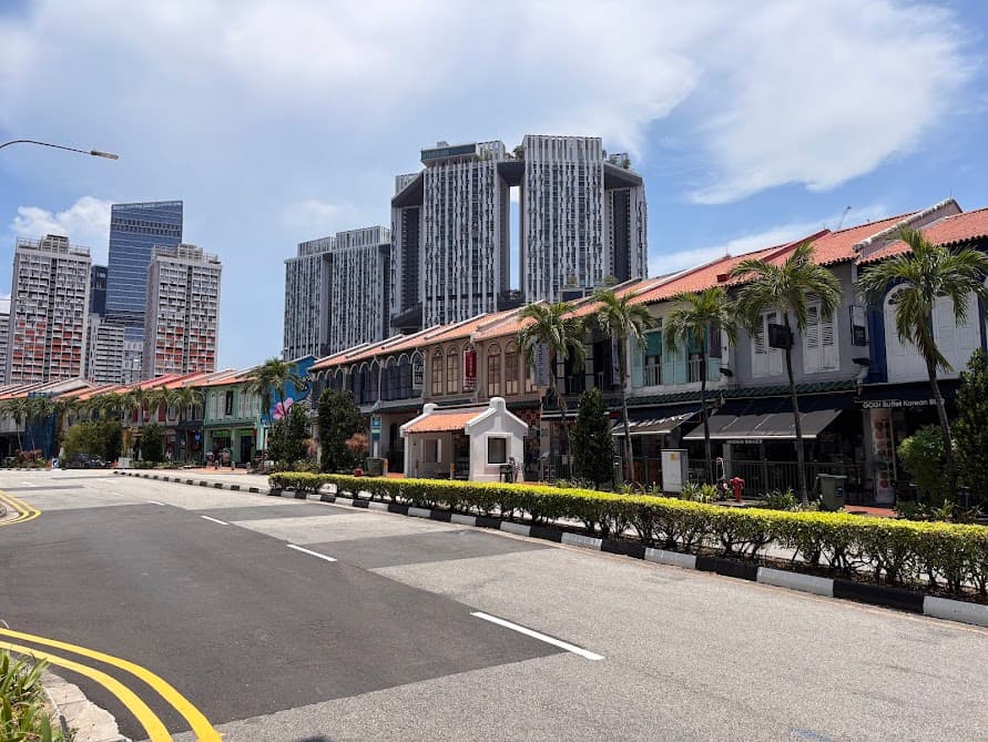
Stop 5: Kreta Ayer Heritage Shophouses
At the start of Kreta Ayer Road is a large mural painted on the front side of the corner shophouse.
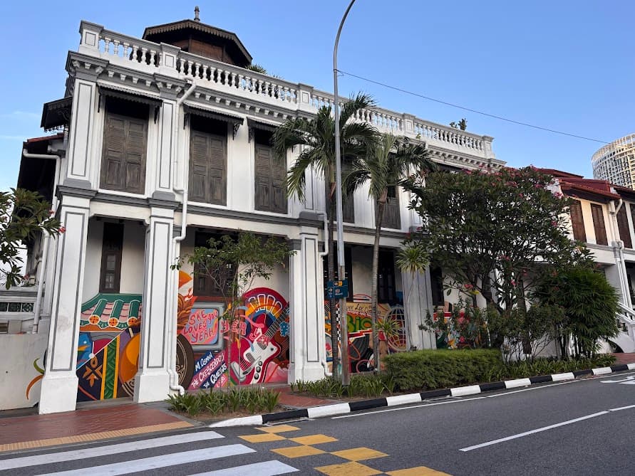
The name Kreta Ayer translates to “water cart” in Malay. Before piped water was common, bullock carts were used to ferry water through this district, which was then a densely populated Hokkien enclave.
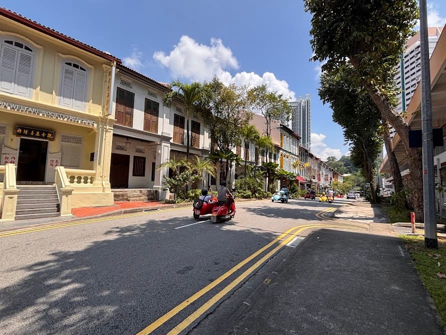
Coincidentally at the time of taking these photos, I spotted an entourage of Vespa sidecars giving visitors a tour of the area. How timely is that? If you are keen to check out the Singapore Vespa Sidecars Heritage Tour for a future trip, it’s a fun experience to save for later.
Continue walking along this stretch of two-storey conservation shophouses. At the end of the row, make a left turn into Keong Saik Road for the next stop.
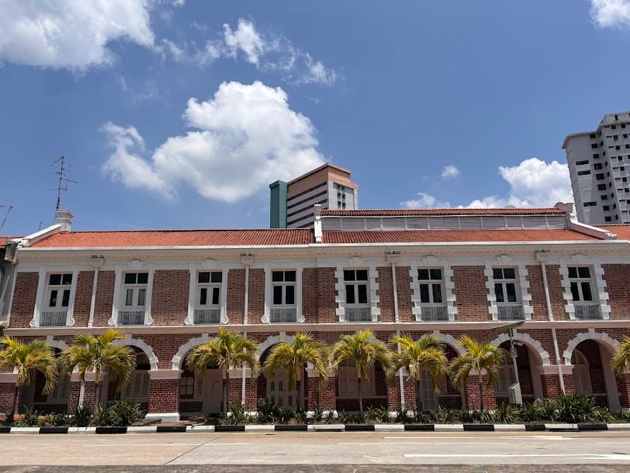
Stop 6: The Art Deco Charm of Tong Ah Building
This iconic triangular building is a striking example of Art Deco shophouse architecture, with its vibrant red window frames and the original “1939” inscription still visible at the very top of the facade.
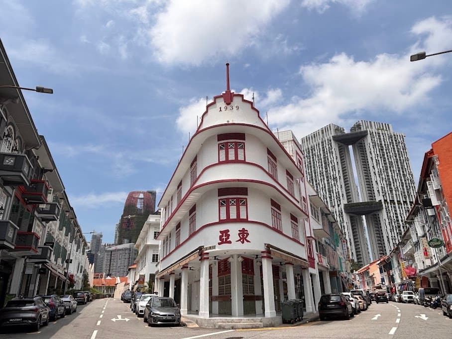
The Chinese characters 東亞 (Tong Ah) refer to the original kopitiam (coffeeshop) that opened here when the building was completed in 1939. For over several decades, it served the locals traditional breakfast: kaya toast, soft-boiled eggs and kopi. When the surrounding Keong Saik area was gripped with vice — brothels and gangsters. The kopitiam kept serving breakfast through all of it.
It’s a popular spot for photography because it has that retro feel and also the building’s unique “wedge” shape perfectly “points” toward the modern skyscrapers in the distance—creating a contrast between old and new Singapore.
Quick Tip: If you want to bring these streets to life while you walk, check out the Keong Saik Red-Light District Audio Tour. It’s an immersive audio guide you download to your phone, full of fascinating, untold stories about the gangsters and secret societies that used to run this neighborhood!
To get to the next stop on the trail, walk along Teck Lim Road to head back out to Neil Road.
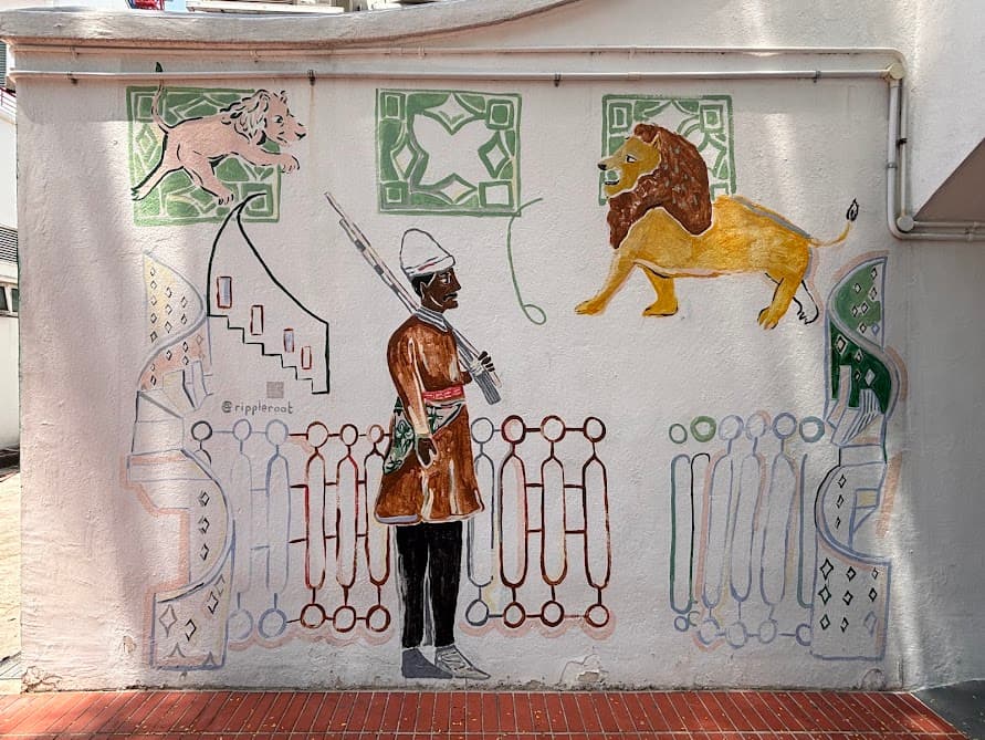
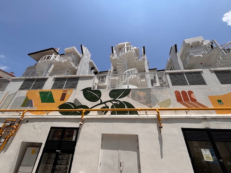
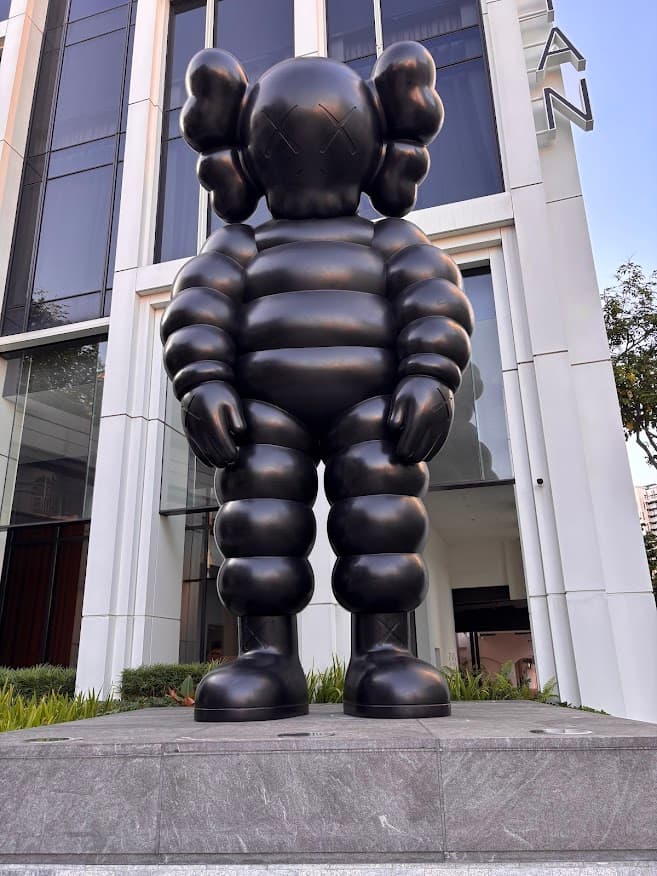
Stop 7: Neil Road Photo Stops
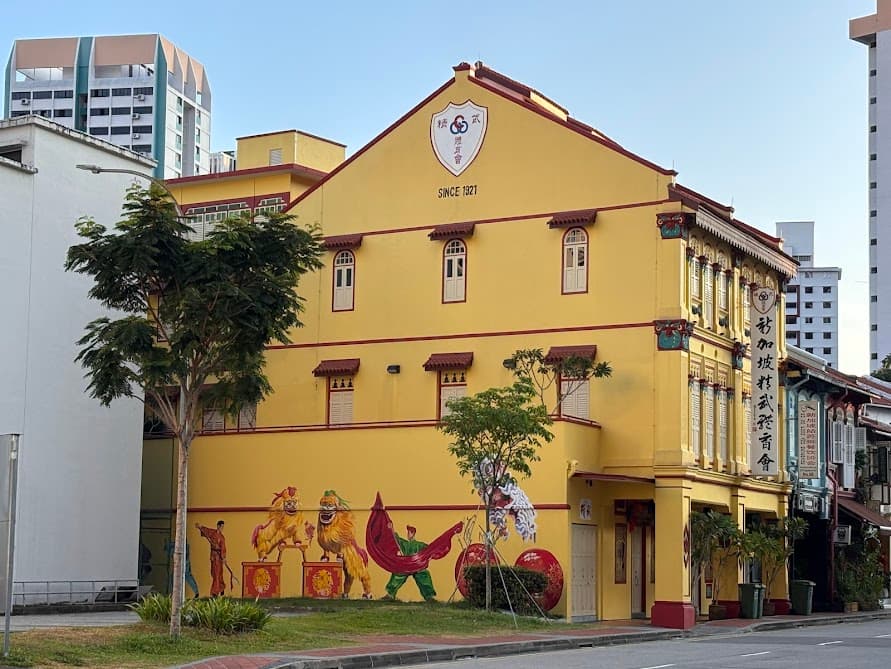
The walk along Neil Road has interesting spots and photo opportunities worth stopping for. Mural of Lion Dance and Martial Arts Poses at 92 Neil Road
Singapore 新加坡 at 114 Neil Road: Where Old Meets New
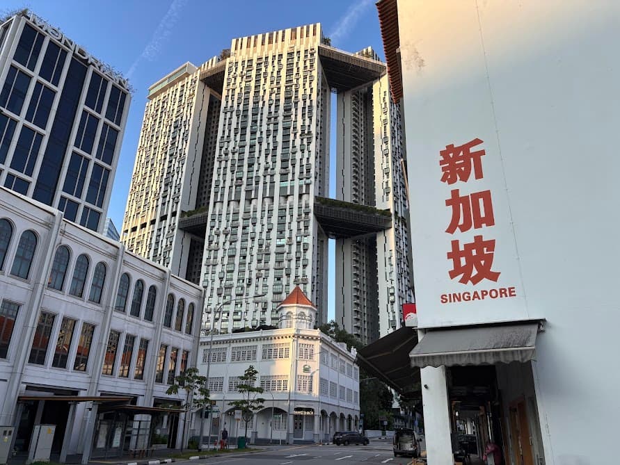
A massive sculpture by renowned artist KAWS outside the Mondrian Singapore Duxton
Stop 8: Duxton Plain Park
Look out for the pedestrian overpass—Duxton Plain Park stretches out directly beneath it. But if you had stood here a hundred years ago — you’d be standing over a railway track.
The Railway History of Duxton Plain Park
In 1907, trains ran right through this narrow strip of land, cutting past the backs of shophouses and rattling the neighbourhood. Residents complained about the noise until the tracks were eventually removed and the land was left behind. It stayed that way for decades, until Lee Kuan Yew officially opened it as a park in May 1961. That gentle curve of the park is the exact bend the old railway once took.
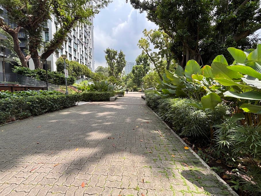
Take a walk through Duxton Plain Park
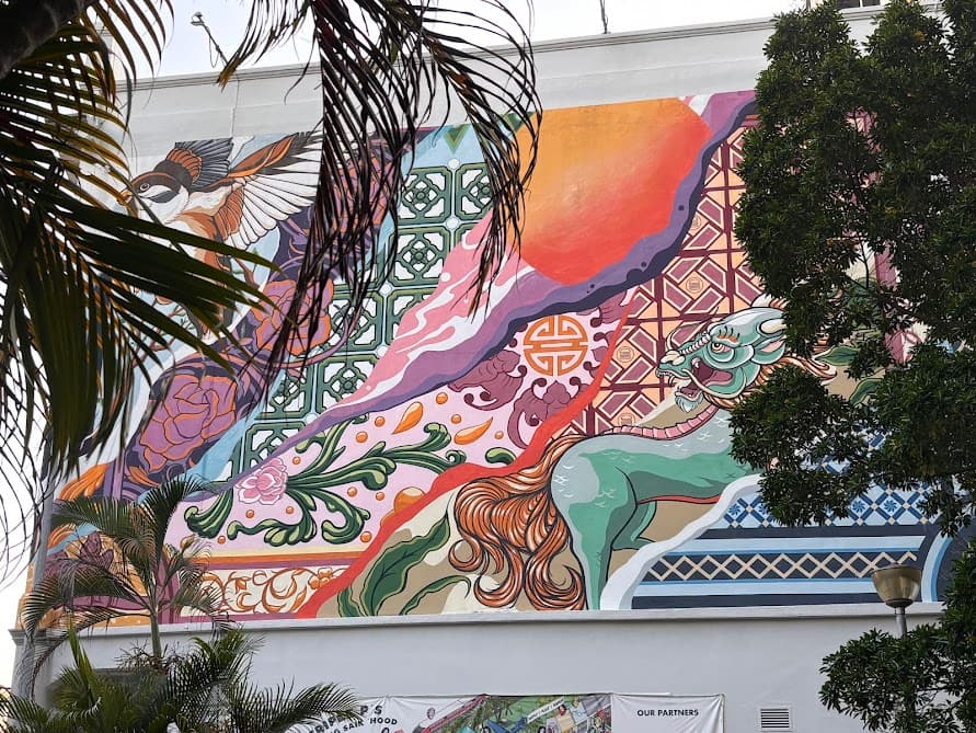
Before heading down, look for another colorful mural painted on the shophouse wall. A flight of stairs right in front of it takes you down into the greenery.

This park is beautifully flanked by rows of mature trees and has a genuinely calm, “secret garden” quality. A great place to decompress!
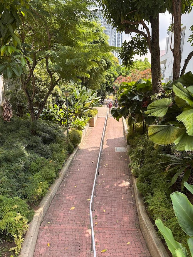
Explore both sides of the park beneath the pedestrian overpass.
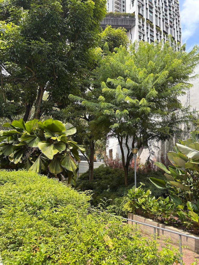
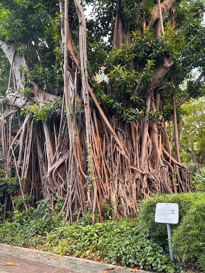
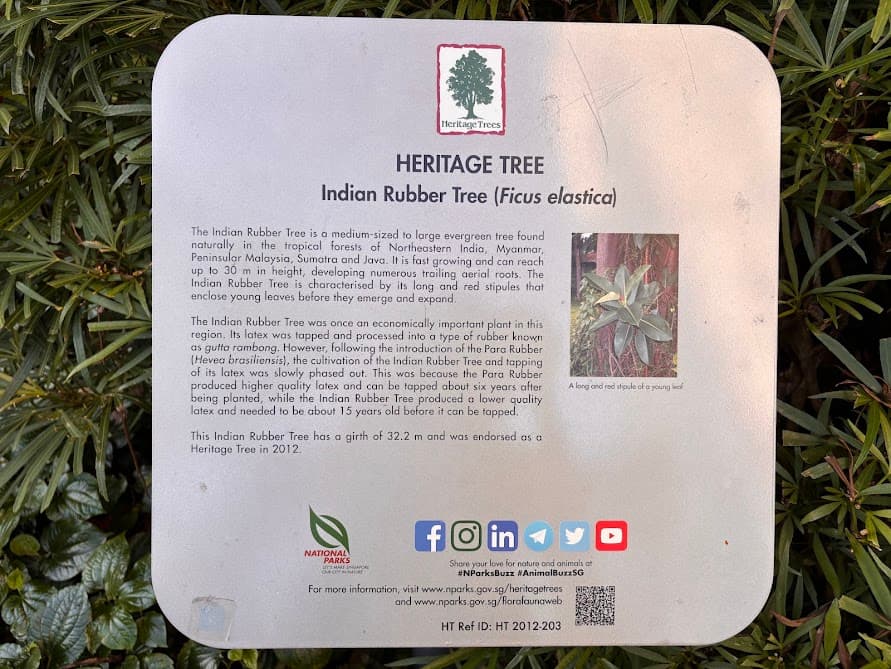
The highlight of this park is the majestic Heritage Tree (a massive Bodhi tree). It is protected by Singapore’s National Parks under the Heritage Tree Scheme, meaning it’s recognized as a vital part of Singapore’s living natural history.
Nearby the heritage tree, look for a long flight of stairs leading up to The Pinnacle@Duxton and follow my map to lead you towards Block 1G.
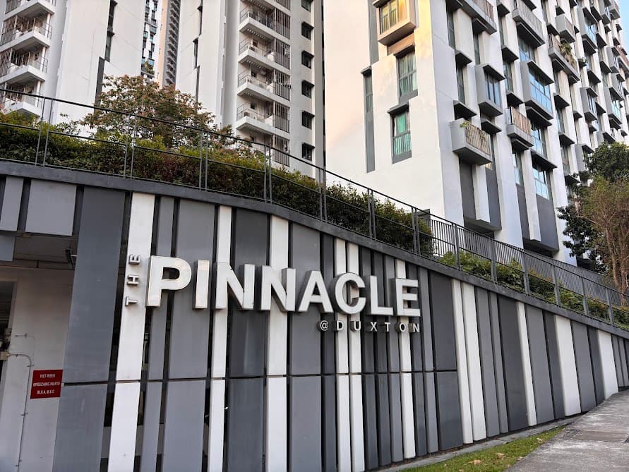
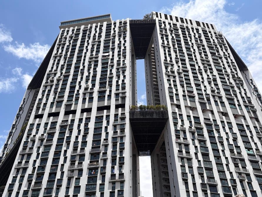
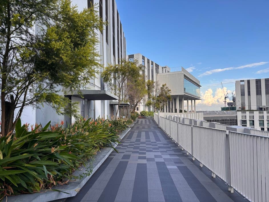
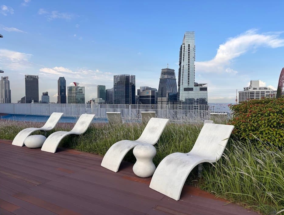
Stop 9: Skybridge at The Pinnacle@Duxton
Next is the centerpiece of the trail—the tallest public housing development in Singapore and an architectural marvel.
Completed in 2009, The Pinnacle@Duxton has garnered numerous local and international accolades for its design and urban innovation one of which is the “World’s Best Housing Development” at the World Architecture Festival 2010. While it looks like a luxury condominium, it is actually a subsidized public housing and was allocated by ballot to Singaporean families.
Fun fact: Pinnacle@Duxton launched its first units in 2004, with 3-bedroom flats (105–108 sqm) priced between SGD 345,000 and SGD 439,000. Today, those same flats sell for up to SGD 1.6 million on the resale market.
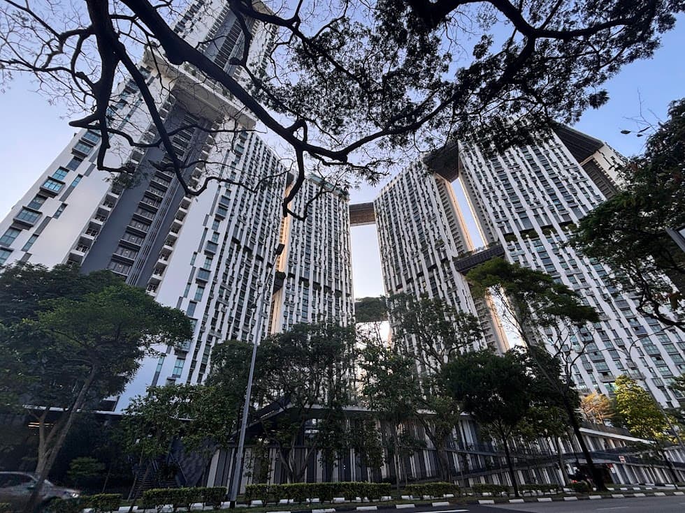
It remains a powerful symbol of how Singapore combines high-density urban living with world-class design.
Buy your tickets from the machine at Level 1, Block 1G.
- Cost & Payment: $6 per person, payable by NETS, VISA or Mastercard
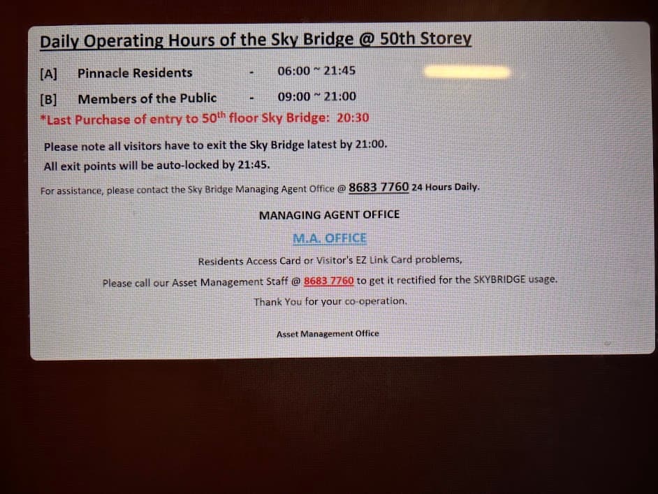
- Opening Hours: 9am – 9pm daily. Last entry at 8.30pm
- Visitor Limit: 150 visitors per day
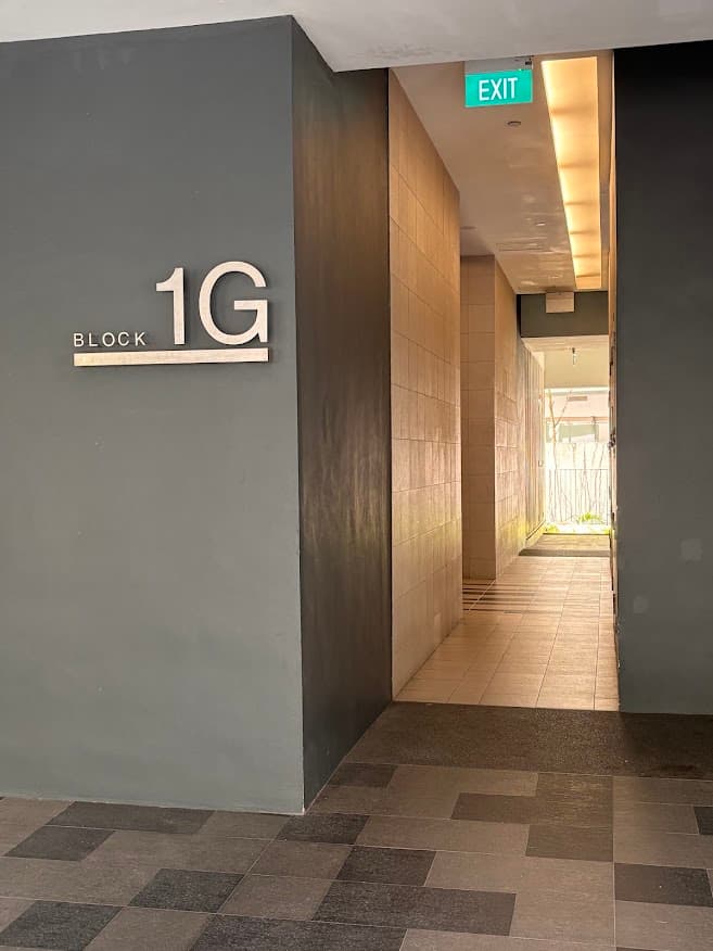
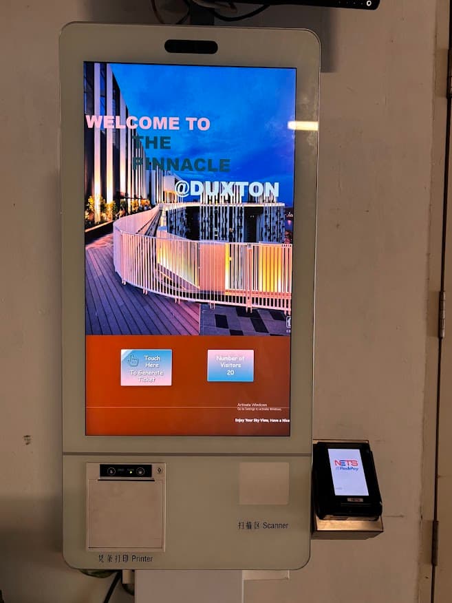
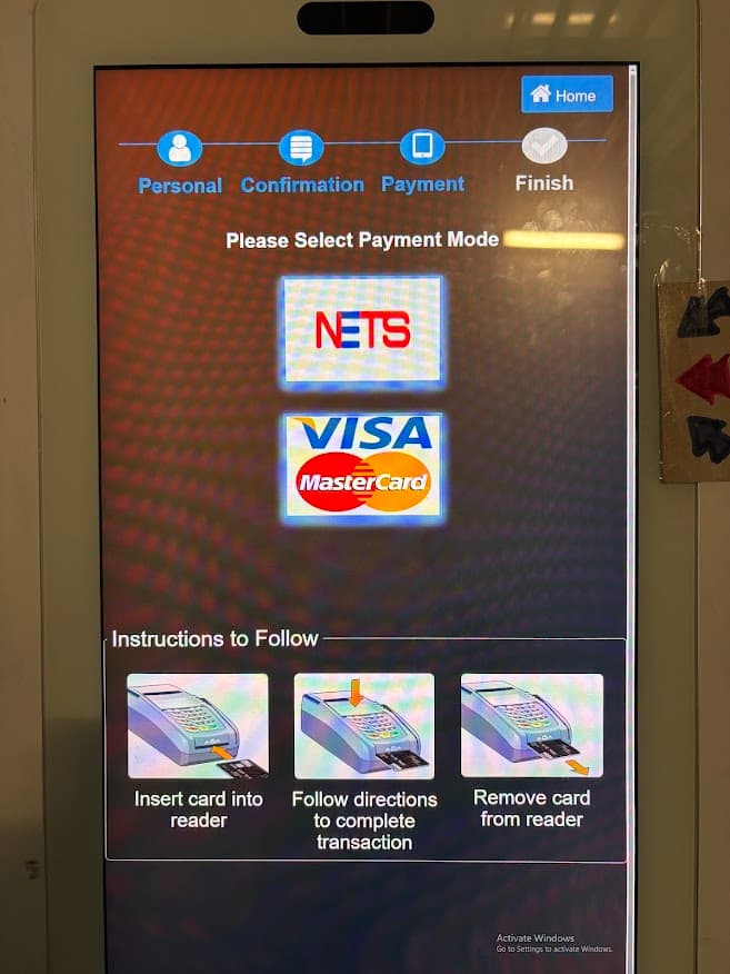
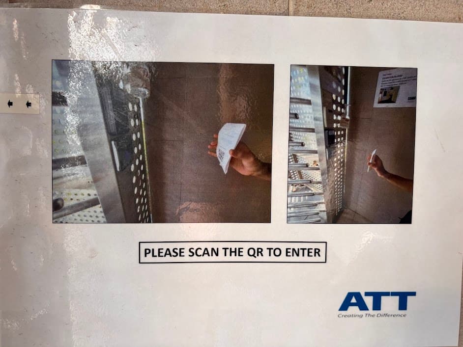
Take the lift at Block 1G to the 50th floor. Scan the QR code on your receipt at the turnstile to enter.
Now here’s what you can expect to see on the skybridge.
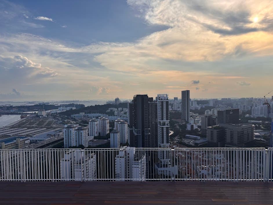
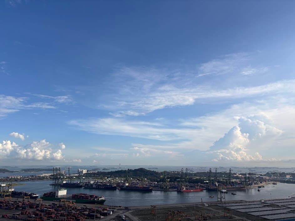
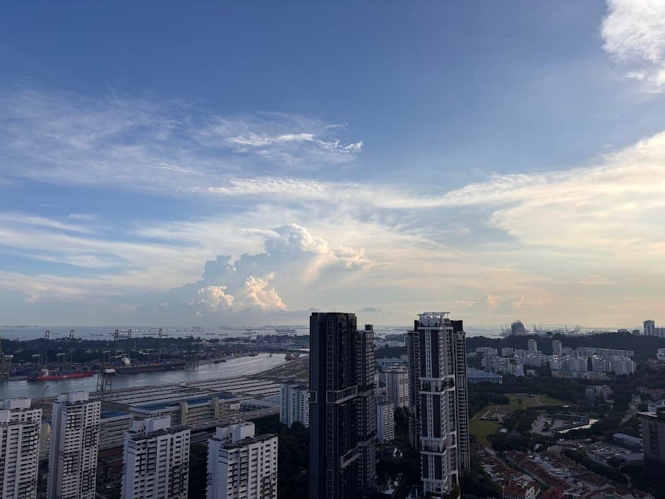
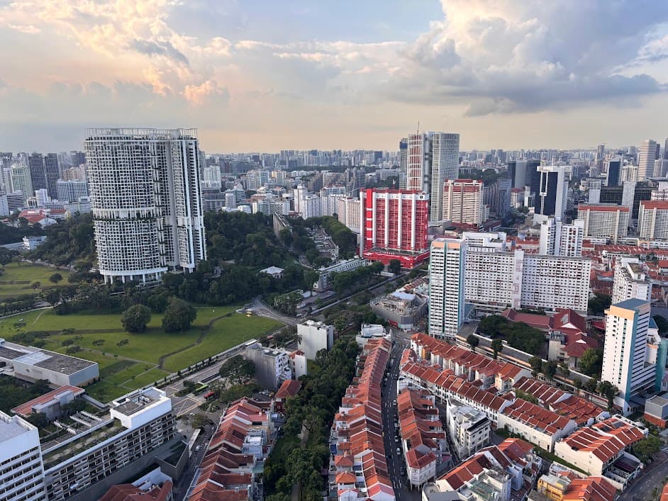
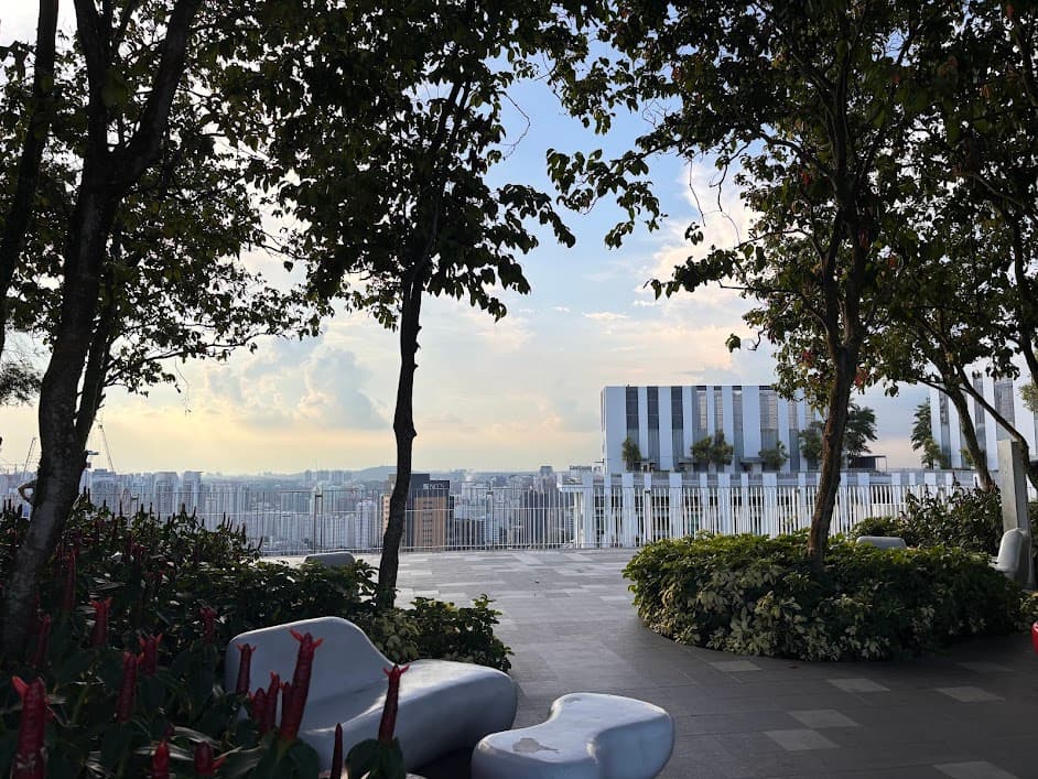
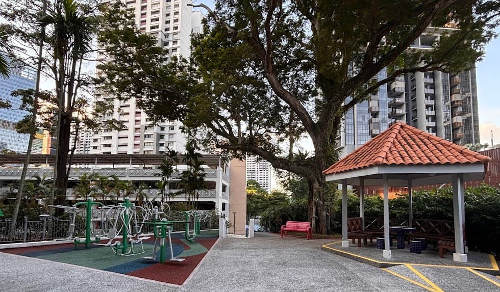
The skybridge viewing deck is also a perfect, breezy spot to sit down, rest your feet and just enjoy the scenery.
Once you’ve finished looking around, take the lift down to the 3rd-floor environmental deck and walk back out towards Neil Road.
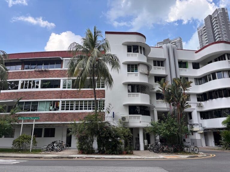
Stop 10: Everton Park HDB Estate
Just a short walk away, Everton Road shows you a completely different side of Singapore public housing.
This is how the majority of Singaporeans live. It provides a look at the country’s social landscape and the functional design of local neighborhoods that most visitors rarely see.
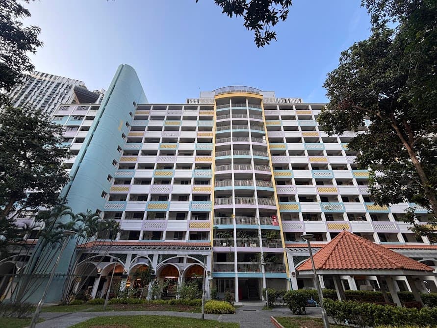
Walk through Everton Park HDB Estate and you’ll see how the vast majority of Singaporeans actually live.
What is an HDB?
HDB stands for Housing & Development Board. It was established in 1960 to provide affordable (government-subsidized), high-quality homes for a growing nation. These neighbourhood estates are functional, self-contained communities.
HDB estates are designed to be self-sufficient, meaning that hawker centres, grocery stores, schools, playgrounds, parks, clinics and public transport are always within walking distance.
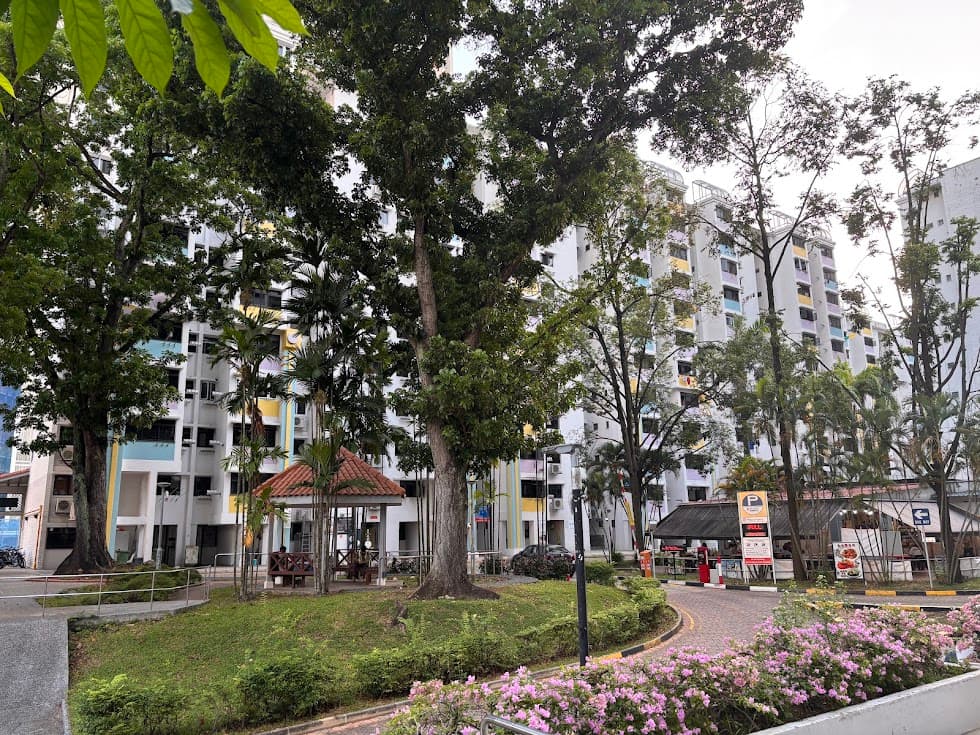
Unlike many other countries, these flats are owned by the residents, not rented. Singapore is a nation of homeowners. Approximately 80% of Singaporeans live in HDB estates like this one but more densely populated.
Everton Park is a very small estate, matured estate, meaning it is one of the older, established neighborhoods. It consists of 8 blocks with about 7,330 residents.
Continue along Neil Road to head to the next stop.
Stop 11: The Provision Shop Mural
Want to see what grocery shopping looked like before modern supermarkets took over?
Head down Spottiswoode Park Road and make a turn onto Everton Road to find the nostalgic “Provision Shop” mural.
Painted by local artist Yip Yew Chong—his artworks are known for bringing Singapore’s past to life. It is also cleverly designed as a “walk-in” scene, you can step right into the artwork—pose as a customer browsing the vintage tin cans, and snap a whimsical photo that looks like you’ve stepped back in time.
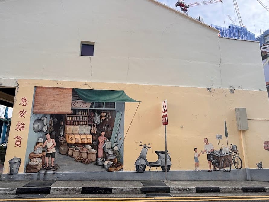
I just enjoy studying his murals. Somehow they seem to connect people to a shared past and it’s so easy to identify with them. Take a moment to look at the small details: the sacks of goods, the hanging wares, the old Vespa scooter.
If you are keen to explore more murals like this in Chinatown , check this out. Now on to the final stop which is just a few metres away.
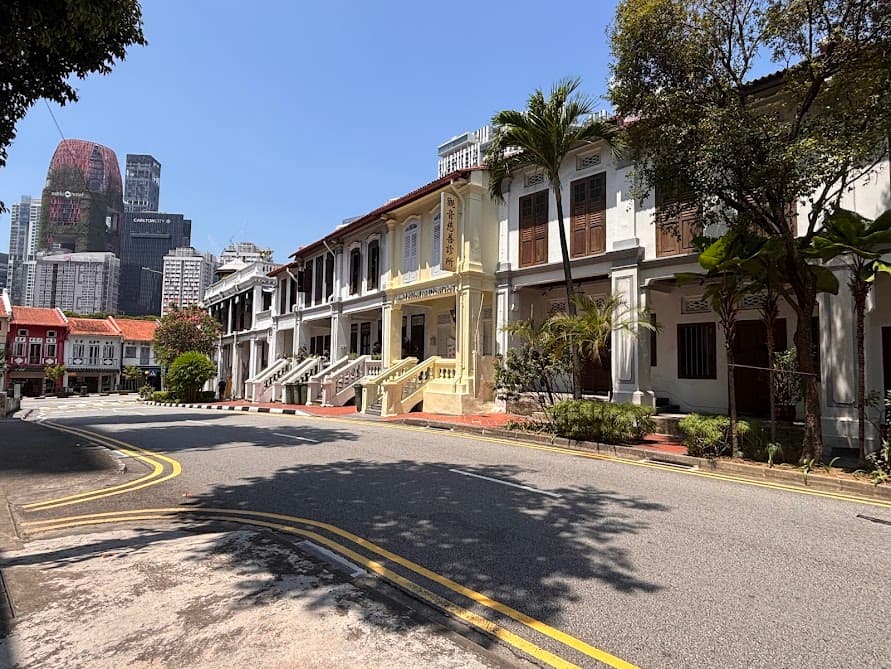
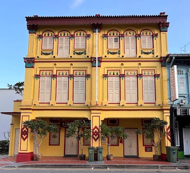
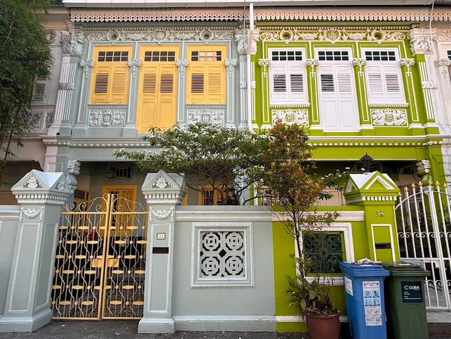
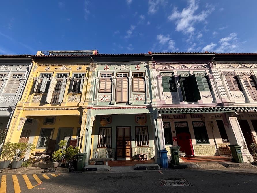
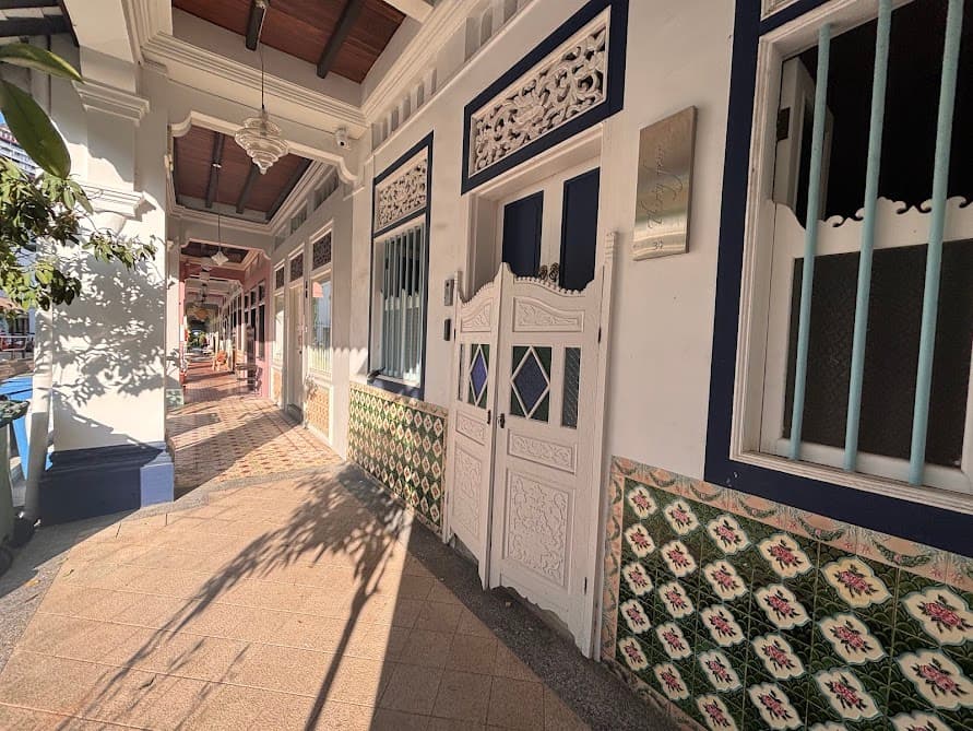
Stop 12: The Peranakan Houses of Blair Road
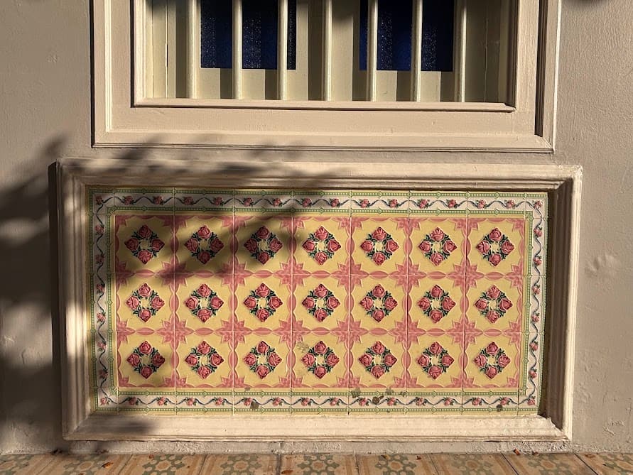
Home to one of the most stunning stretches of heritage architecture in Singapore. This quiet street is lined with rows of traditional Peranakan terrace houses in jewel-bright colors, featuring ornate floral tiles and classic louvred shutters. It’s hard to resist taking photos of the intricacy and details.
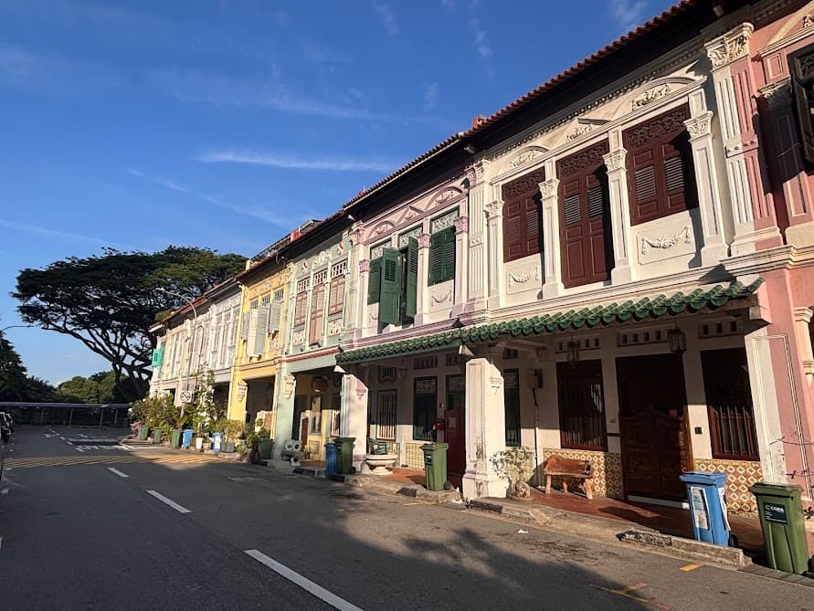
Note: As these are private residences, please be mindful of the residents’ privacy and keep to the pavement.
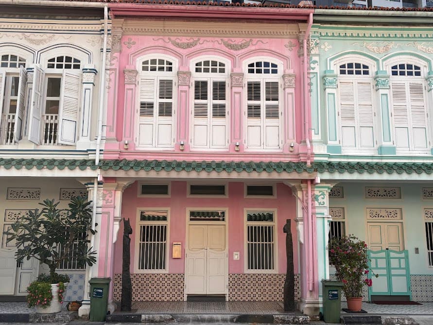
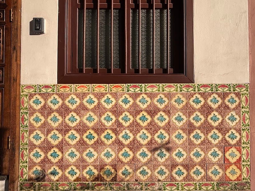
If you usually associate Peranakan architecture with the busy streets of Katong or Joo Chiat, Blair Road will be a pleasant surprise. It offers the same historic charm and colorful aesthetics but less crowded, making it much easier to enjoy the details. And with that, the walking route concludes here.
Finishing Point: Outram Park MRT Station (Exit 5)
Head over to Outram Park MRT station, which connects three major lines (East-West Line, North East Line, and Thomson-East Coast Line), making it easy to head to your next destination.
If you found value in this guide, check out my other blog posts to keep exploring!
Planning to explore Chinatown? Check out my Chinatown guide to discover more where all the popular murals are and must-see heritage attractions.
If it’s your first time in Singapore, read this blogpost to learn how to navigate Singapore’s hawker centres.